This bizarre formation on the Rock of Gibraltar is known as a "banner cloud," a type of orographic cloud, meaning it is created due to the shape of the land below it
[📹 Met Office Gibraltar] #globalmuseum #weather
This bizarre formation on the Rock of Gibraltar is known as a "banner cloud," a type of orographic cloud, meaning it is created due to the shape of the land below it
[📹 Met Office Gibraltar] #globalmuseum #weather
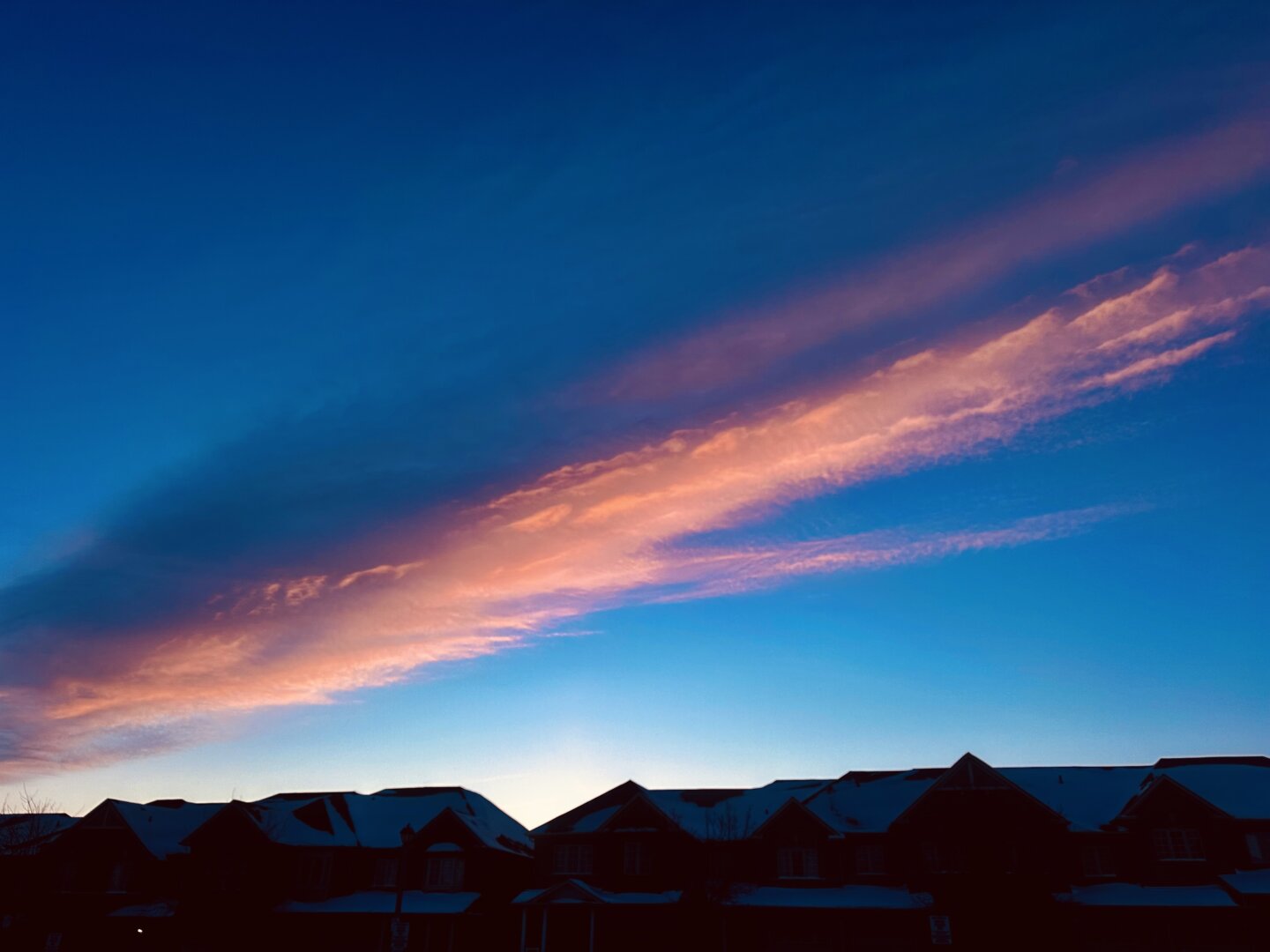
Pink Sun Sign: Another big, bright, frigid day Time.
#Weather #Photography
Pink Sun Sign: Another big, bright, frigid day Time.
#Weather #Photography
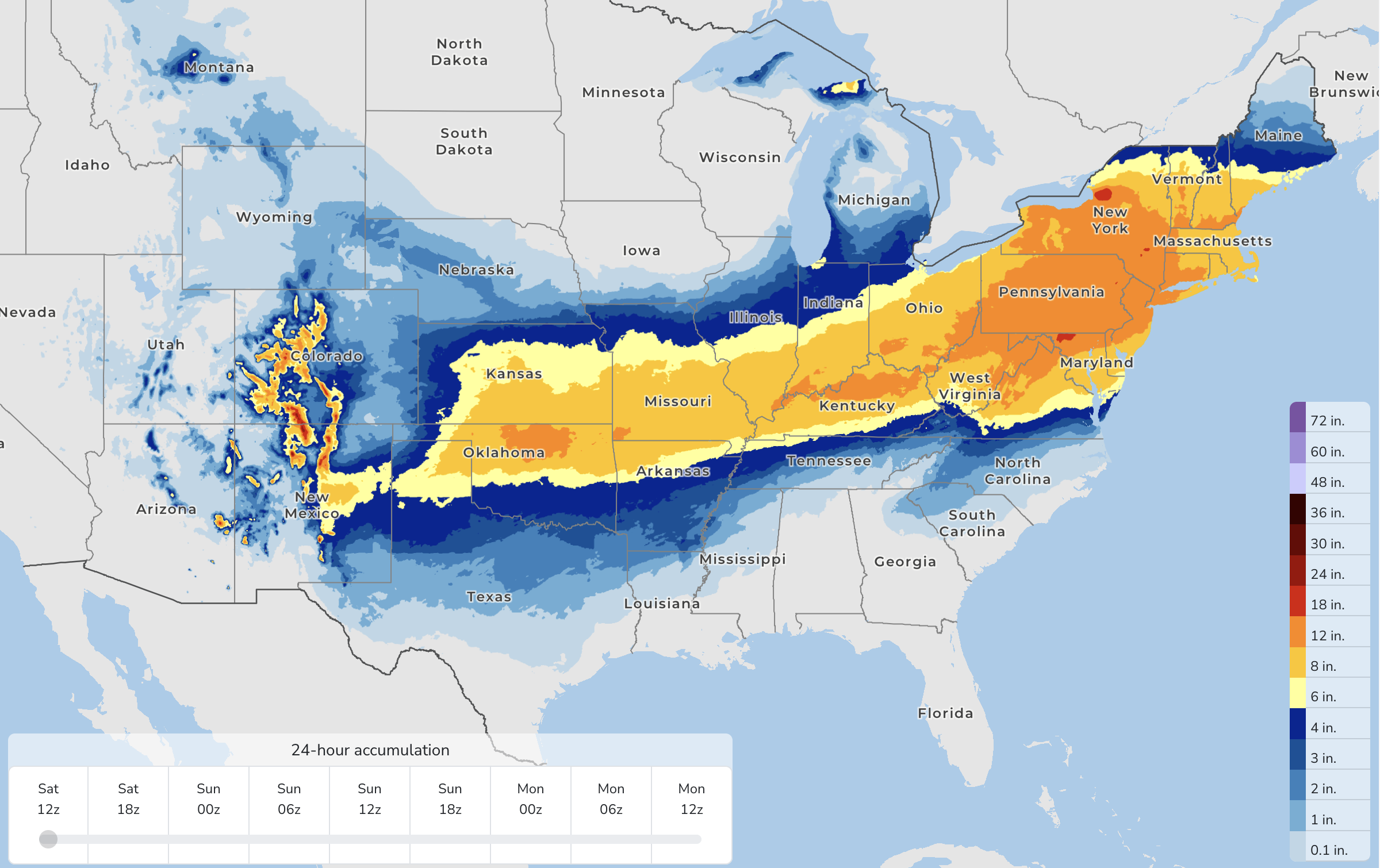
Looking forward to my flight on Monday. (Cool data from NOAA/NWS Probabilistic Precipitation Portal: https://www.wpc.ncep.noaa.gov/Prob_Precip/)
#Weather
pourvu qu’elle échappe à la tempête
Dog Looking Outside Window, Photo by Elliott Erwitt, 1967
#meteo #goretti #weather #dogs #photography
pourvu qu’elle échappe à la tempête
Dog Looking Outside Window, Photo by Elliott Erwitt, 1967
#meteo #goretti #weather #dogs #photography
trois départements de l’Ouest placés en vigilance orange aux vagues submersion à partir de samedi
Bram Sels, Cthulhu, Edgar Allan Poe
trois départements de l’Ouest placés en vigilance orange aux vagues submersion à partir de samedi
Bram Sels, Cthulhu, Edgar Allan Poe
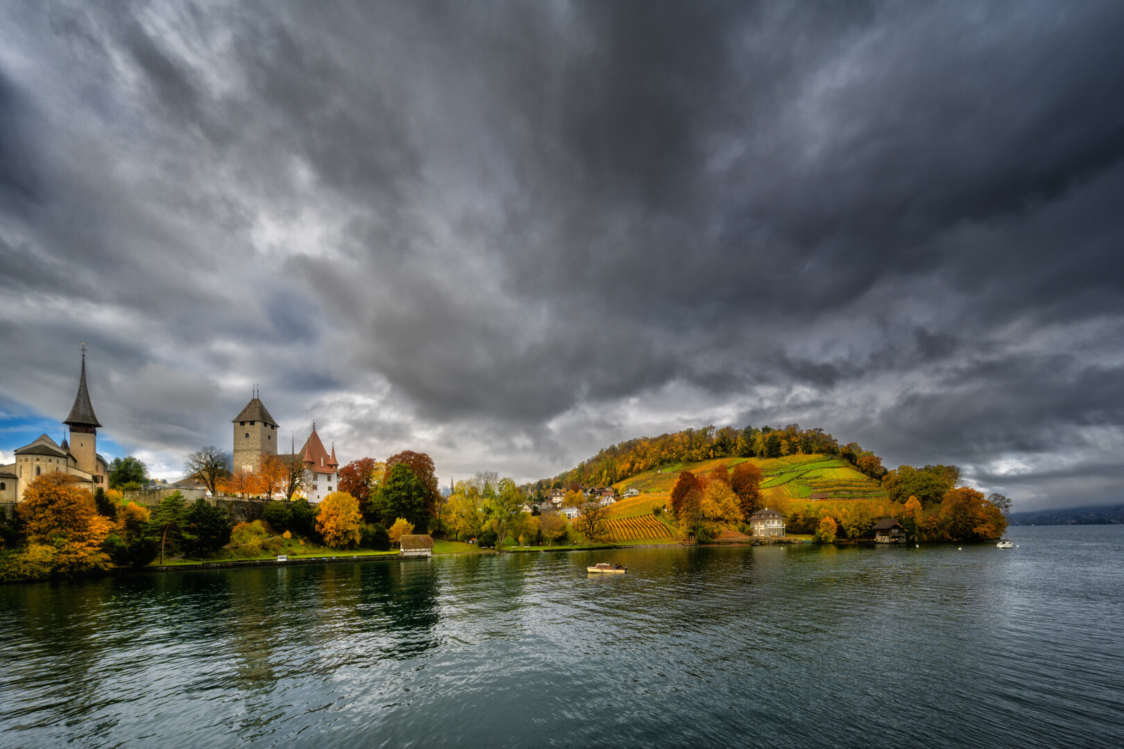
Spiez
Schlosskirche, Schloss, Walerain, Rebberg, Spiezberg
#NikonZ7II #NikonZ #NIKON Z 7II | 14mm | f/8 | 1/250s | 30/10/2025
#hess_photography #photography #fotografie #landscapephotography #landschaftsfotografie #BernerOberland #castle #church #clouds #KantonBern #lake #LakeThun #Rebberg #Schweiz #Spiez #Thunersee #vineyard #weather
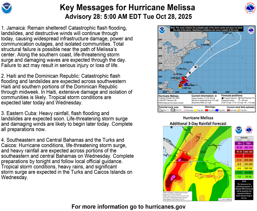
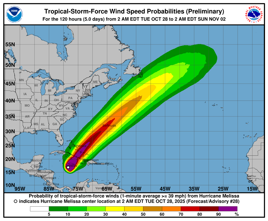
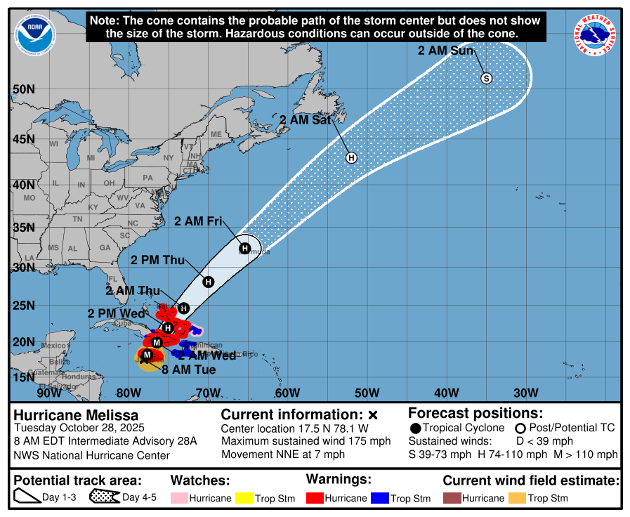
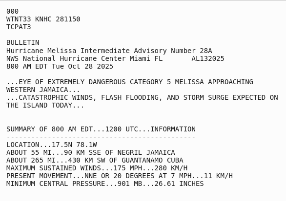
Track of Melissa has taken the storm much more west ward than I hoped, and it's smack S off of Jamaica island. This means the ENE stream which WILL push it NE will go through the most populous area.
Latest estimates put the storm going much further NE, because the ENE stream has solidified and grown stronger, maybe due to Tropical Storm Sonia bumping a mass of air, WSW off Mexico.
https://www.nhc.noaa.gov/text/refresh/MIATCPAT3+shtml/281150.shtml?
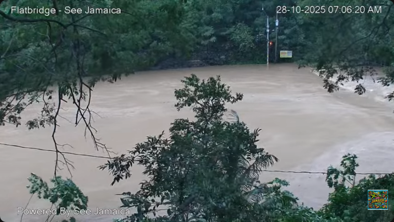
You can have an idea of the amount of rain and water being dumped onto Jamaica, right now here. Bridge pictures ~24hrs ago, and now.
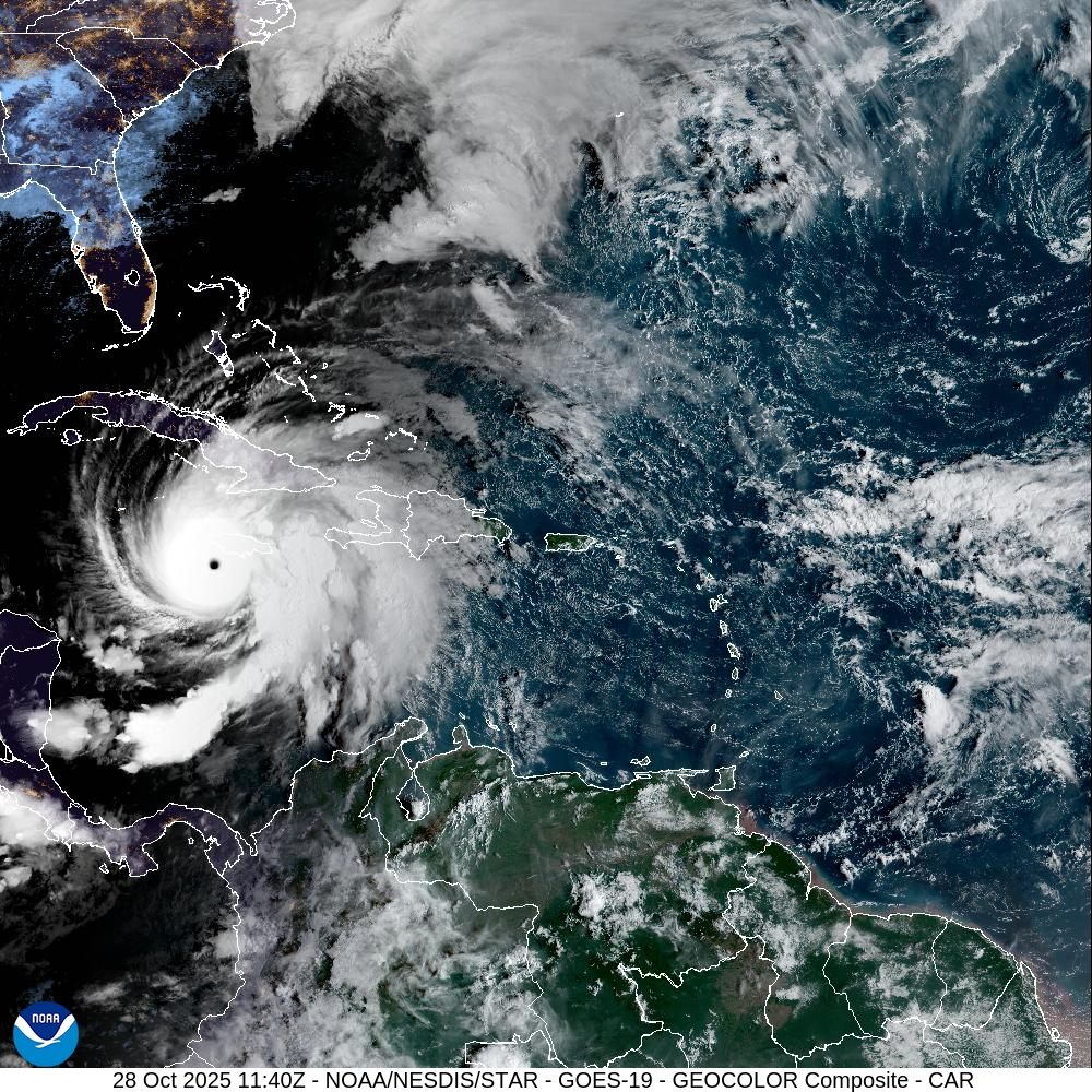
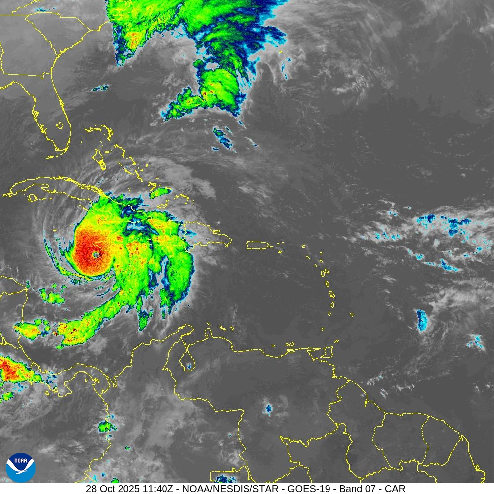
Melissa is, now, very much a picture perfect hurricane, 901mbar and 175mph/280kmh sustained winds at the core vortex walls.
The IR signature is scary, but it shows a slight cooling of the core vortex. This means the storm has stopped "feeding" is will hopefully start dissipating energy, as it drags over landmasses. Unfortunately, that energy will be dissipated by wrecking #Jamaica and #Haiti.
Track of Melissa has taken the storm much more west ward than I hoped, and it's smack S off of Jamaica island. This means the ENE stream which WILL push it NE will go through the most populous area.
Latest estimates put the storm going much further NE, because the ENE stream has solidified and grown stronger, maybe due to Tropical Storm Sonia bumping a mass of air, WSW off Mexico.
https://www.nhc.noaa.gov/text/refresh/MIATCPAT3+shtml/281150.shtml?
Summer heat still comes.
It should've stopped weeks ago,
had we not fueled it.
#haiku #senryu #poem #ShortPoem #SmallPoem #SmallPoems #climate #weather #heat #UnseasonablyWarm #FossilFuels #oil #gas #ClimateChange #ClimateCrisis
I figure a good number of you heads’ll be interested to know this exists. Picked it up at blessed Housmans the other day, and really looking forward to getting into it when I’m done with “Fascist Yoga” (to which it seems like it’ll be a useful corrective/palate cleanser).
Brace for impact. The #ECMWF#weather #model promises scorching temperatures over #Europe the coming week. Anomalies of up to 15-20 C higher than normal are expected.
This weather is brought to you by climate change (for those who claim it's been hot before: weather is what happens, climate is the probability it happens. And this has become significantly more probable because greenhouse gases and physics.)