A Stunning Map Of The Atlantic Ocean Seafloor — And One Woman’s Pioneering Quest To Publish It
--
The geology of the ocean floor is truly spectacular — perhaps even more than land geology. Unfortunately, it's really hard to study.
--
https://www.zmescience.com/other/geopicture/atlantic-ridge-marie-tharp-geology-rep/ <-- shared technical article
--
https://en.wikipedia.org/wiki/Marie_Tharp <-- shared Wikipedia page, Marie Tharp
--
https://marietharp.ldeo.columbia.edu/about-marie-tharp <-- shared page about Marie Tharp, Lamont-Doherty Earth Observatory, Columbia University
--
https://youtu.be/gsQGOJtwdv0?si=PQsVzv98gutL3hpX <-- shared video, “… Why We Celebrate Marie Tharp”
--
#spatial mapping #mapmaker #cartographer #MarieTharp #remotesensing #sonar #earthobservation #history #model #modeling #spatialanalysis #geology #seafloor #ocean #marine #oceanfloor #AtlanticOcean #geologist #pioneering #paleoceanographer #marinegeology #OceanSpeaks
@Women+ in Geospatial | #WomenInGeoscience
#JeRecrute (Pas moi, ma tutelle) Un.e Ingénieur.e mise en production et exploitation de services aux données pour le pôle FormaTerre (12 mois) à Paris
https://emploi.cnrs.fr/Offres/CDD/UMR7154-SABGAL-051/Default.aspx
#CNRS #DataTerra #RemoteSensing
#JeRecrute (Pas moi, ma tutelle) Un.e Ingénieur.e mise en production et exploitation de services aux données pour le pôle FormaTerre (12 mois) à Paris
https://emploi.cnrs.fr/Offres/CDD/UMR7154-SABGAL-051/Default.aspx
#CNRS #DataTerra #RemoteSensing
A small rediscovery from my archive.
In June 2023, during Alberta’s extreme wildfire season, I created a day-by-day animation using NASA FIRMS fire-hotspot data.
The animation shows how quickly ignition points spread across the province — almost like watching the forest "breathe fire" in slow motion.
It didn’t get much attention on LinkedIn… but this feels like the right place to share it again.
If you’re into remote sensing, wildfire monitoring, or environmental analytics — this one might be interesting.
#Wildfire #Alberta #Canada #RemoteSensing #EarthObservation #NASA #FIRMS #ClimateCrisis #EnvironmentalScience #GIS #RStats #DataViz #SciComm #FOSS #BorealForest #Taiga
Digital Elevation Models, Old Maps, And Cultural Heritage—Geospatial Assets For The Digital Humanities
--
https://doi.org/10.3389/fcomm.2025.1507385 <-- shared paper
--
#GIS #spatial #mapping #spatialanalysis #spatiotemporal #water #hydrography #remotesensing #earthobservation #landscape #humanimpacts #landforms #DEM #elevation #LiDAR #oldmaps #historicmaps #culture #society #infrastructure #community #change #DigitalHumanities #geography #cartography #environment #culturalheritage #Nederlands #LingeRiver #engineering #precisionmapping #understanding #history
🫐 The Blueberry Map Experiment — modelling meets the mountains
In 2022, while living with my family in the Czech Republic, I built a digital map of wild blueberry hotspots in the Jizera Mountains.
At first, it looked like a fun summer project — our neighbors used the map to find the best berry spots and enjoy the landscape.
But behind it was a serious experiment: I tested species distribution modelling (SDM) methods, later adapted for wide-world rare earth element prediction.
Within this “blueberry project” I:
🔹 automated the full spatial workflow in R and QGIS,
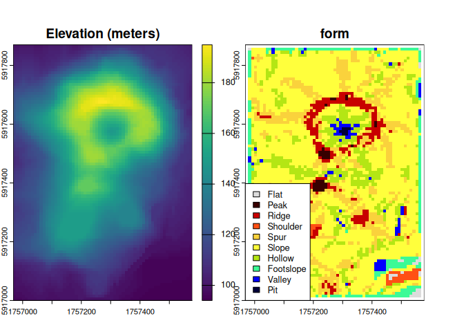
🔹 generated geomorphons and other terrain-based predictors,
🔹 built and validated ML models,
🔹 created probability maps and tested them in the field.
✨ What started as a family hobby became a field-tested workflow for predictive geoscience.
#DataScience #MachineLearning #GIS #SpatialModeling #SDM #CzechRepublic #RemoteSensing #Geoscience #RStats #EnvironmentalData #PredictiveMapping #LandscapeEcology #RareEarthElements #CriticalMinerals
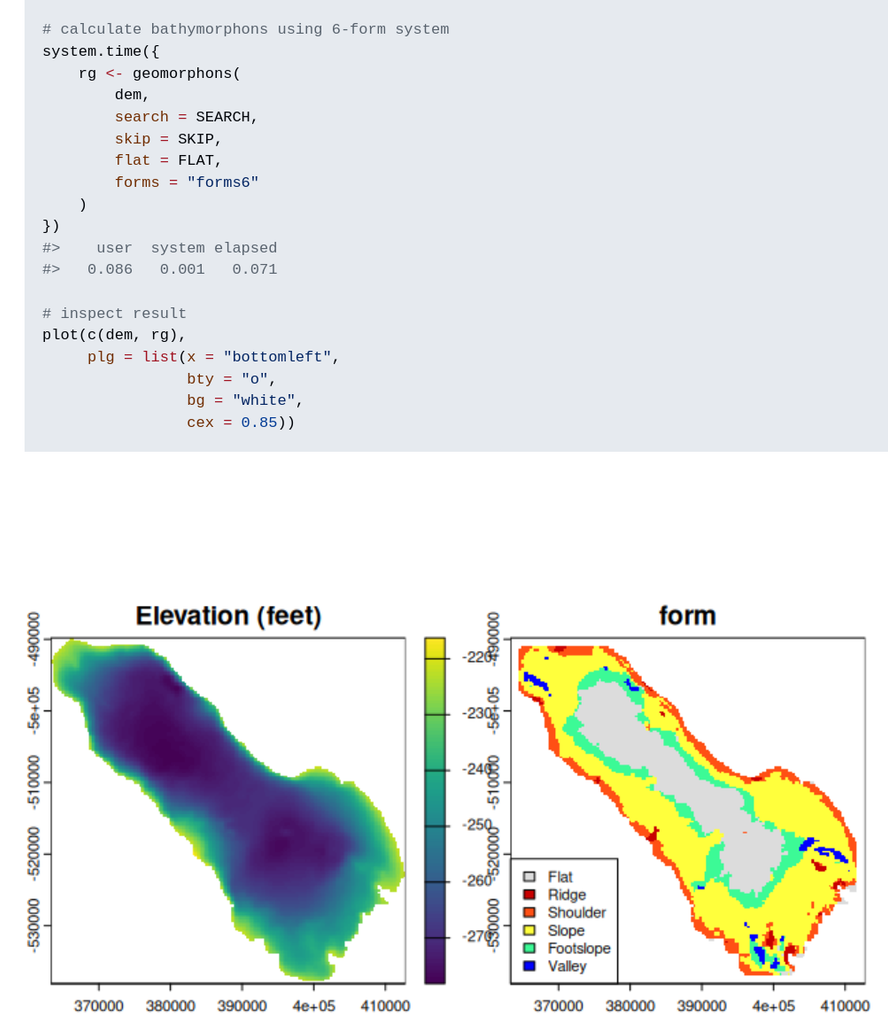
New R package: rgeomorphon 📦 by Andrew Brown
Classifies terrain forms using a parallel C++ implementation of the geomorphon algorithm.
New R package: rgeomorphon 📦 by Andrew Brown
Classifies terrain forms using a parallel C++ implementation of the geomorphon algorithm.


