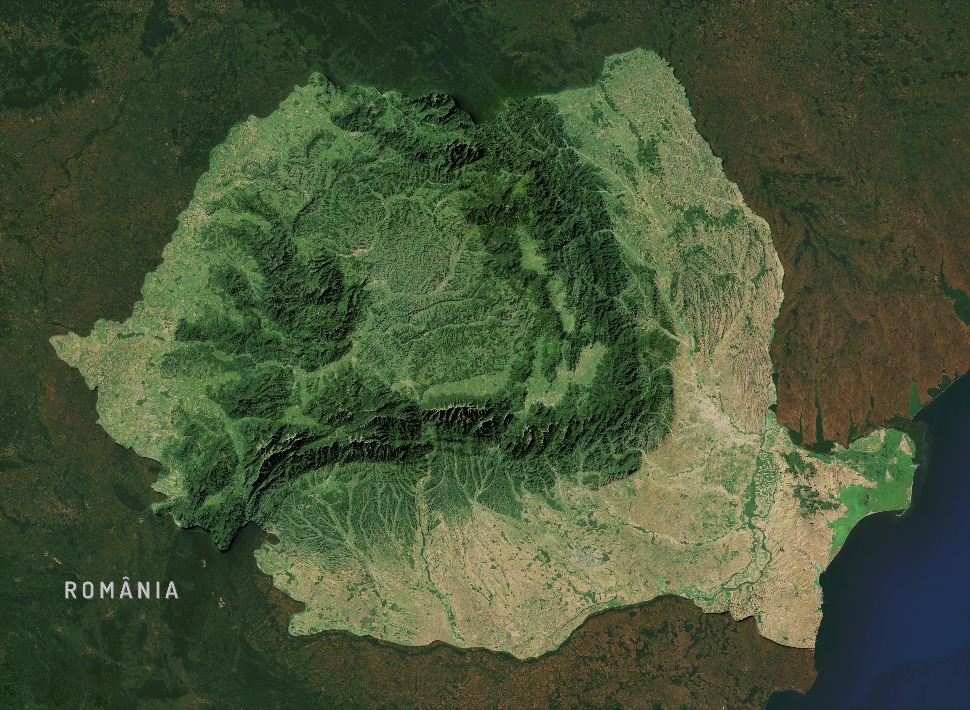
🌊 hashtag#30DayMapChallenge Day 20: Water
Estaba intentando recrear el estilo de relieve de Eduard Imhof con software libre cuando, por accidente, subí un poco el nivel del mar. Me gustó cómo eso destacó el contraste entre la hidrografía y el relieve.
Usé GIMP y QGIS, tomando como referencia los trabajos de @john_m_nelson y Tom Patterson. #GIMP #QGIS #Cartography
An official atlas of North Korea
https://www.cartographerstale.com/p/an-official-atlas-of-north-korea
#HackerNews #NorthKorea #Atlas #Cartography #Geography #News #Exploration
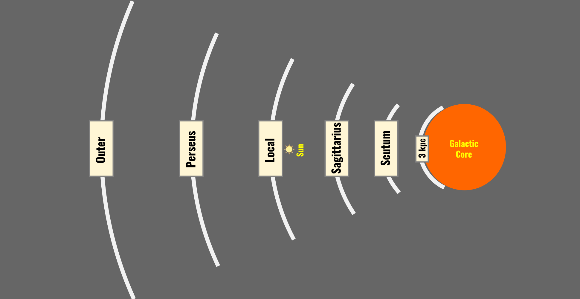
A Revised Three-dimensional Visualization of the Local Group of Galaxies, by Antonio Ciccolella
☑️ research note of the AAS https://doi.org/10.3847/2515-5172/ae1efc
☑️ ultra-high resolution version https://flic.kr/p/2rD6yGU
#Cosmology #LocalGroup #galaxies #MilkyWay #Andromeda #Astronomy #Astrodon #visualization #science #Cosmography #map #cartography
A Revised Three-dimensional Visualization of the Local Group of Galaxies
Digital Elevation Models, Old Maps, And Cultural Heritage—Geospatial Assets For The Digital Humanities
--
https://doi.org/10.3389/fcomm.2025.1507385 <-- shared paper
--
#GIS #spatial #mapping #spatialanalysis #spatiotemporal #water #hydrography #remotesensing #earthobservation #landscape #humanimpacts #landforms #DEM #elevation #LiDAR #oldmaps #historicmaps #culture #society #infrastructure #community #change #DigitalHumanities #geography #cartography #environment #culturalheritage #Nederlands #LingeRiver #engineering #precisionmapping #understanding #history
🗺️ Day 13 — #30DayMapChallenge | 10 Minute Map
Today’s theme was all about speed: create a full map in just 10 minutes. ⏱️
I put together a quick Melbourne land-use map, showing how residential areas, parks, industrial zones, and transport corridors shape the city. Even in a fast workflow, the spatial patterns come through so clearly.
#GIS #Geospatial #Mapping #Cartography #Mapston #30DayMapChallenge #Melbourne #Australia
En.osm.town is an independent Mastodon server for OpenStreetMap people. Funding graciously provided by the OpenStreetMap Foundation.
This server has been online since 2018.
You can find out more at https://en.osm.town/about or contact the admin account @compass
#FeaturedServer #OpenStreetMap #OSM #Maps #Mapping #Cartography #GIS #Geospatial #Geography #Mastodon #Fediverse #FreeFediverse
Sunday doodles & dragons. Time to go on an adventure again!
#fantasymaps #ttrpg #cartography #dragon #pencil #handdrawn #sketch #noai
Sunday doodles & dragons. Time to go on an adventure again!
#fantasymaps #ttrpg #cartography #dragon #pencil #handdrawn #sketch #noai
Hi Everyone: Just a reminder that the deadline for proposals for the INTERNATIONAL CONFERENCE ON THE HISTORY OF CARTOGRAPHY in Prague-Brno in July 2026 is rapidly approaching. It is 14 November! Please get your proposals in!!!!
For info, goto https://ichc2026.org
Hi Everyone: Just a reminder that the deadline for proposals for the INTERNATIONAL CONFERENCE ON THE HISTORY OF CARTOGRAPHY in Prague-Brno in July 2026 is rapidly approaching. It is 14 November! Please get your proposals in!!!!
For info, goto https://ichc2026.org
Map of the ratio between the total number of farm animals and the number of inhabitants per municipality in the Netherlands based on data of Statistics Netherlands (CBS).
#30daymapchallenge day 3: polygons #maps #thenetherlands #statistics #cartography
Map of the ratio between the total number of farm animals and the number of inhabitants per municipality in the Netherlands based on data of Statistics Netherlands (CBS).
#30daymapchallenge day 3: polygons #maps #thenetherlands #statistics #cartography
It's been a long journey (over year since I began), but there's finally now a first public release of the oblique hachures method. With many thanks to @SouthArrowMaps, who significantly refined the methodology from what I began with.
Writeup: https://docs.google.com/document/d/1GFSgxLI5F2UOevCXBG22GBKVbpuKddTl7MoBTrPHB3s/edit?tab=t.0
Script: https://github.com/pinakographos/non-planimetric-hachures