Discussion
Loading...

#Tag

Log in
  • About
  • Code of conduct
  • Privacy
  • Users
  • Instances
  • About Bonfire
Conspiracy of Cartographers
@ConspiracyOfCartographers@mastodon.social  ·  activity timestamp last month

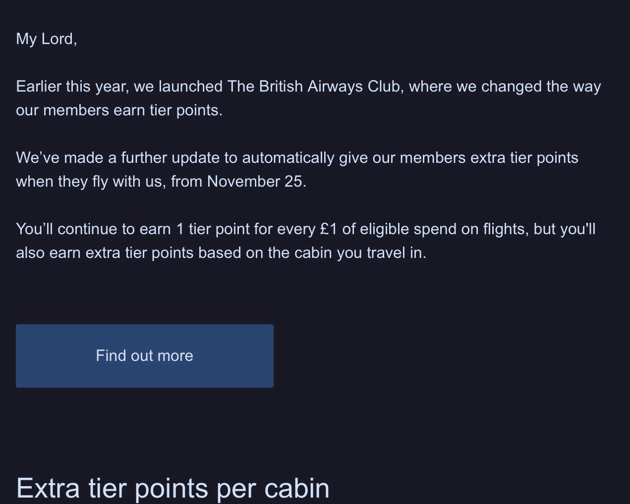
Last year, I checked the “viscount” box on the British Airways registration.

Now my spam begins with “My Lord”

My Lord, Earlier this year, we launched The British Airways Club, where we changed the way our members earn tier points. We've made a further update to automatically give our members extra tier points when they fly with us, from November 25. You'll continue to earn 1 tier point for every £1 of eligible spend on flights, but you'll also earn extra tier points based on the cabin you travel in. Find out more Extra tier points per cabin
Conspiracy of Cartographers
@ConspiracyOfCartographers@mastodon.social replied  ·  activity timestamp last month

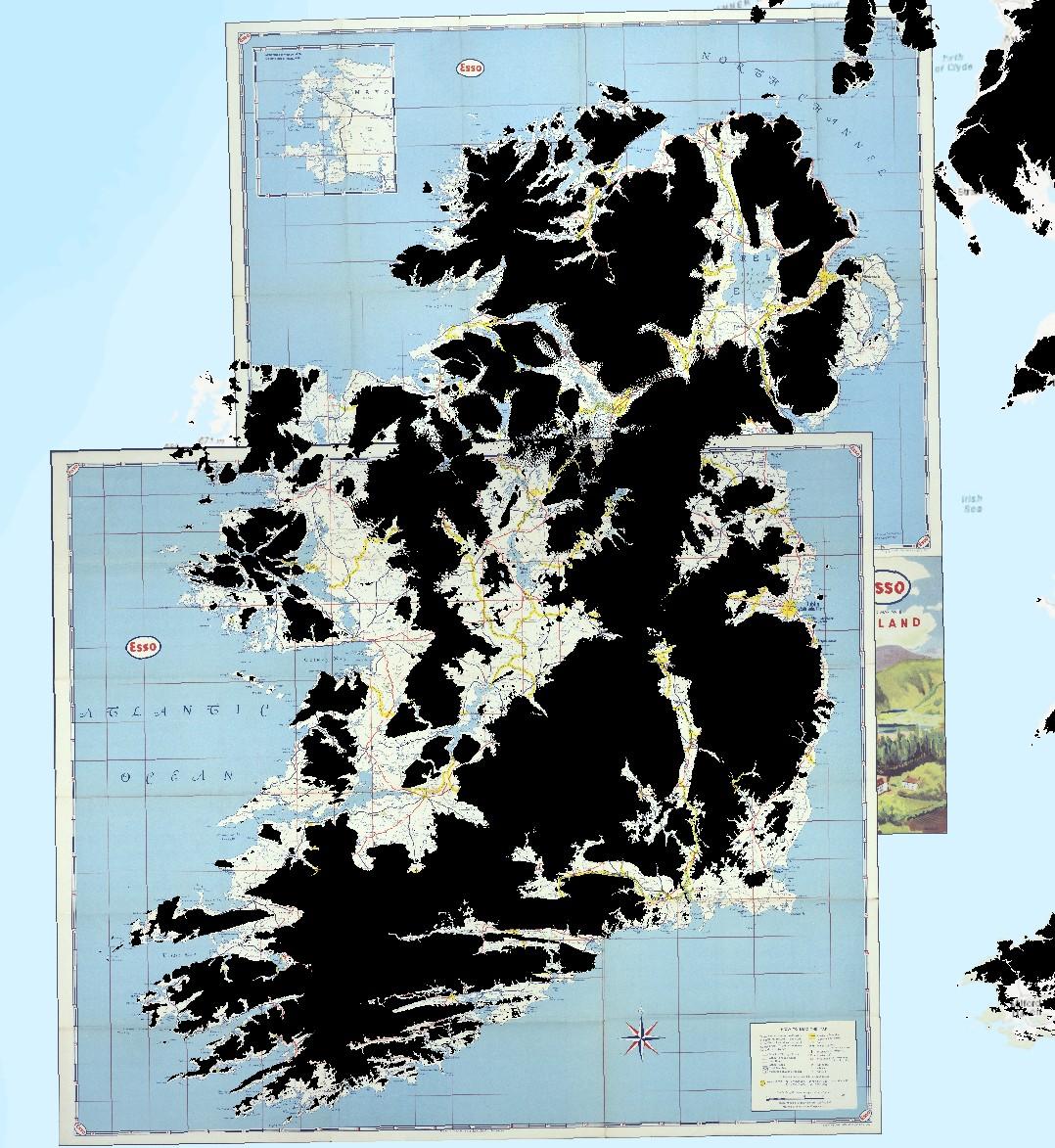
Hello Mastodoners! Be sure to check out the #Petrofuture series...re-authored gas station maps with the ultimate sea level rise.

https://conspiracyofcartographers.com/

  • Copy link
  • Flag this comment
  • Block
Jonathan Schofield boosted
Conspiracy of Cartographers
@ConspiracyOfCartographers@mastodon.social  ·  activity timestamp 6 months ago

The process for making a #Petrofuture map...

Step 1—Digitize Map
Step 2—Georeference Map
—> Step 3—Add 66m Sea Level Mask (shown here is the 66m sea level mask on top of two georeferenced vintage Esso maps of Ireland)

*I used m-dashes. Please don't flag me as ai.

Two vintage Esso road maps of Ireland--north and south, shown georeferenced in GIS software. On top of the two overlapping maps are black areas showing where the land is above 66m. Ireland becomes a series of smaller islands.
  • Copy link
  • Flag this post
  • Block
Conspiracy of Cartographers
@ConspiracyOfCartographers@mastodon.social  ·  activity timestamp 10 months ago

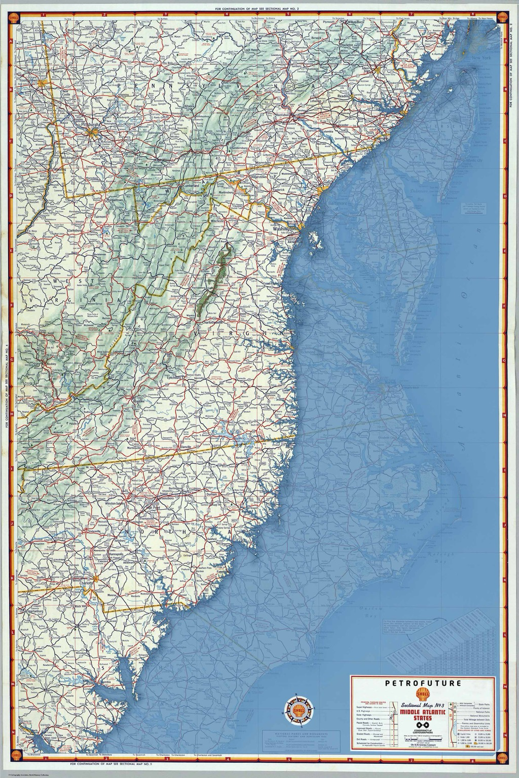
Moving further south, the #Petrofuture map of the Mid-Atlantic coast—66m sea level rise on a 1956 Shell Oil road map. Higher-res images:
https://conspiracyofcartographers.com/petrofuturegallery/ #climateChange #maps #cartography #climateCrisis #outsiderArt #clifi #greenWashing #washingtonDC #worldbuilding #richmondVA #midAtlantic

Petrofuture of the mid-Atlantic coast…66m sea level rise on a 1956 Shell Oil map. The coast is inundated for miles and miles
  • Copy link
  • Flag this post
  • Block

bonfire.cafe

A space for Bonfire maintainers and contributors to communicate

bonfire.cafe: About · Code of conduct · Privacy · Users · Instances
Bonfire social · 1.0.1-alpha.40 no JS en
Automatic federation enabled
Log in
  • Explore
  • About
  • Members
  • Code of Conduct