Anyone know good #FLOSS software for annotating #maps with things like boundaries and objects, and publishing them somehow, like as a PDF or SVG or on a simple map server? I don't want to be adding objects to #OSM, and it should be usable by someone without a deep understanding of GIS or mapping software. It could certainly involve updating a local OSM subset using OSM's data model as long as it's user friendly and the user doesn't need a deep understanding of the data model.
Anyone know good #FLOSS software for annotating #maps with things like boundaries and objects, and publishing them somehow, like as a PDF or SVG or on a simple map server? I don't want to be adding objects to #OSM, and it should be usable by someone without a deep understanding of GIS or mapping software. It could certainly involve updating a local OSM subset using OSM's data model as long as it's user friendly and the user doesn't need a deep understanding of the data model.
"The experience motivated the two Rice University students to create a digital map documenting U.S. Immigration Customs Agency activity, and awareness around their project has been growing since it went live in June."
"The experience motivated the two Rice University students to create a digital map documenting U.S. Immigration Customs Agency activity, and awareness around their project has been growing since it went live in June."
Proud to announce that the Revista de Historia de América has just published my article about mapping Alta California at the time of Mexican independence! (PDF link at page left.)
https://www.revistasipgh.org/index.php/rehiam/article/view/5979/
Proud to announce that the Revista de Historia de América has just published my article about mapping Alta California at the time of Mexican independence! (PDF link at page left.)
https://www.revistasipgh.org/index.php/rehiam/article/view/5979/
Get REAL.
No F$&!ing AI. All human made.
DnD, 5e, OSR, Dragonbane, Maps, Poetry.
Laidback DM.
https://www.drivethrurpg.com/en/publisher/13989/laidback-dm
#5e #map #Pathfinder2 #Dragonbane #osr #shadowdark #DungeonsAndDragons #maps #dnd #oldschool #Poetry #OldSchoolEssentials #poems #Dragon #DnD5e
Get REAL.
No F$&!ing AI. All human made.
DnD, 5e, OSR, Dragonbane, Maps, Poetry.
Laidback DM.
https://www.drivethrurpg.com/en/publisher/13989/laidback-dm
#5e #map #Pathfinder2 #Dragonbane #osr #shadowdark #DungeonsAndDragons #maps #dnd #oldschool #Poetry #OldSchoolEssentials #poems #Dragon #DnD5e
If anyone's following along, now streetmap.co.uk has disappeared, a very similar (arguably easier to use) site with #ordnancesurvey #maps (1:25k and 1:50k and larger scales) is:
💡 𝗥𝗲𝘀𝗲𝗮𝗿𝗰𝗵 𝗦𝘂𝗽𝗽𝗼𝗿𝘁 𝗛𝘂𝗯 𝟱 𝗙𝗲𝗯𝗿𝘂𝗮𝗿𝘆: embark on your GIS journey with an 𝗜𝗻𝘁𝗿𝗼𝗱𝘂𝗰𝘁𝗶𝗼𝗻 𝘁𝗼 𝗔𝗿𝗰𝗚𝗜𝗦!🚀 This beginner-friendly #course is tailored for #PhDstudents and #researchers @rug.nl who are eager to integrate #GIS into their #research.
This course is the first in a three-part ArcGIS series.
ℹ️ https://www.rug.nl/society-business/center-for-information-technology/research/rsh/rshcalendar/
Now streetmap.co.uk appears to be offline, where else can one still get #OrdnanceSurvey #Landranger or #Explorer (1:50k or 1:25k) maps online?
If anyone's following along, now streetmap.co.uk has disappeared, a very similar (arguably easier to use) site with #ordnancesurvey #maps (1:25k and 1:50k and larger scales) is:
💡 𝗥𝗲𝘀𝗲𝗮𝗿𝗰𝗵 𝗦𝘂𝗽𝗽𝗼𝗿𝘁 𝗛𝘂𝗯 𝟱 𝗙𝗲𝗯𝗿𝘂𝗮𝗿𝘆: embark on your GIS journey with an 𝗜𝗻𝘁𝗿𝗼𝗱𝘂𝗰𝘁𝗶𝗼𝗻 𝘁𝗼 𝗔𝗿𝗰𝗚𝗜𝗦!🚀 This beginner-friendly #course is tailored for #PhDstudents and #researchers @rug.nl who are eager to integrate #GIS into their #research.
This course is the first in a three-part ArcGIS series.
ℹ️ https://www.rug.nl/society-business/center-for-information-technology/research/rsh/rshcalendar/
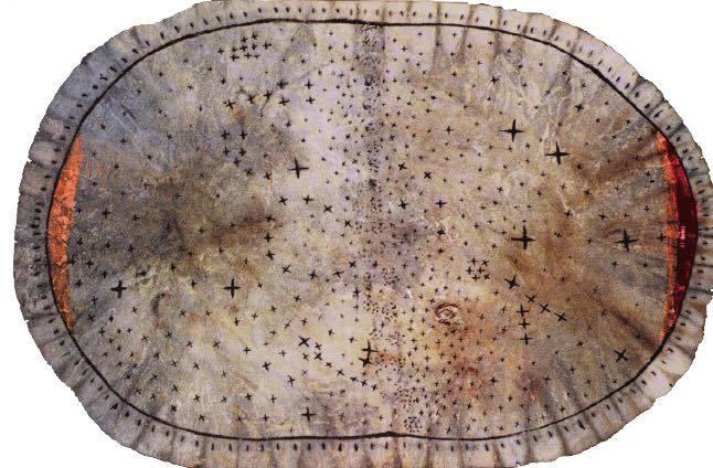
300 year old leather star map by the Skidi, one of the four bands of the Pawnee tribe. The Skidi Pawnee historically lived on the Central Plains of Nebraska and Kansas.
@archaeologyart #globalmuseum #maps #NativeAmericans
Some updates on the map
- fixed fold-out bug
- streetnames added when using routing from popup
- removed all unpkg links
- improved icons
Lokjo is growing more, so in the background I've been working on a completely new update. (approx march/april)
This includes a much-asked EU-substitute page.
If you want to donate a bit:
You peeps have a nice sunday. 😊
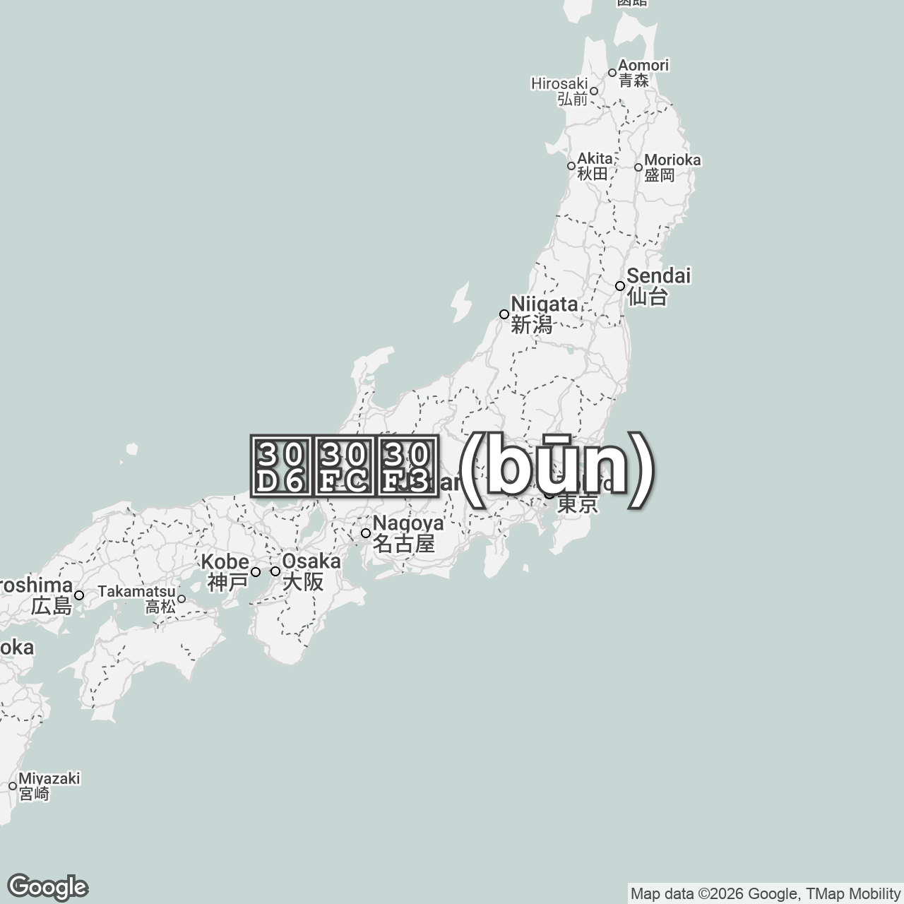
The sound of "bee buzzing" in Japanese!
#language #linguistics #onomatopoeia #maps
Now streetmap.co.uk appears to be offline, where else can one still get #OrdnanceSurvey #Landranger or #Explorer (1:50k or 1:25k) maps online?
Hey, so for school, I've been assigned a research project of my own choosing, I chose cartography, for this work, I need to do a practical part, if you wish to help me, I have a questionnaire in Catalan and English for people to fill in regarding their relationship with #maps
https://forms.gle/kpvdDBJ9XV7syrVn9 Versió Catalana
https://forms.gle/552tcST7iSw5aJfi8 English Version
Apologies for using a google product, I'm not happy about it, but my entire school system uses google products and I'm extremely time limited.
Some updates on the map
- fixed fold-out bug
- streetnames added when using routing from popup
- removed all unpkg links
- improved icons
Lokjo is growing more, so in the background I've been working on a completely new update. (approx march/april)
This includes a much-asked EU-substitute page.
If you want to donate a bit:
You peeps have a nice sunday. 😊
Why I 🧡 the web.
Generate beautiful, minimalist map posters for any city in the world.


