Discussion
Loading...

Post

  • About
  • Code of conduct
  • Privacy
  • Users
  • Instances
  • About Bonfire
Conspiracy of Cartographers
@ConspiracyOfCartographers@mastodon.social  ·  activity timestamp 8 months ago

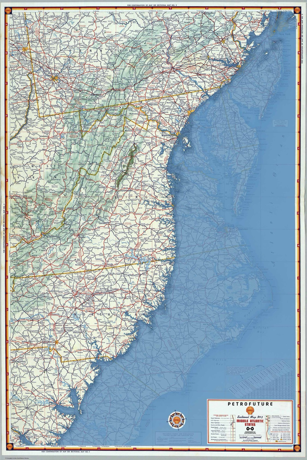
Moving further south, the #Petrofuture map of the Mid-Atlantic coast—66m sea level rise on a 1956 Shell Oil road map. Higher-res images:
https://conspiracyofcartographers.com/petrofuturegallery/ #climateChange #maps #cartography #climateCrisis #outsiderArt #clifi #greenWashing #washingtonDC #worldbuilding #richmondVA #midAtlantic

Petrofuture of the mid-Atlantic coast…66m sea level rise on a 1956 Shell Oil map. The coast is inundated for miles and miles
  • Copy link
  • Flag this post
  • Block
Log in

bonfire.cafe

A space for Bonfire maintainers and contributors to communicate

bonfire.cafe: About · Code of conduct · Privacy · Users · Instances
Bonfire social · 1.0.0-rc.3.21 no JS en
Automatic federation enabled
  • Explore
  • About
  • Members
  • Code of Conduct
Home
Login