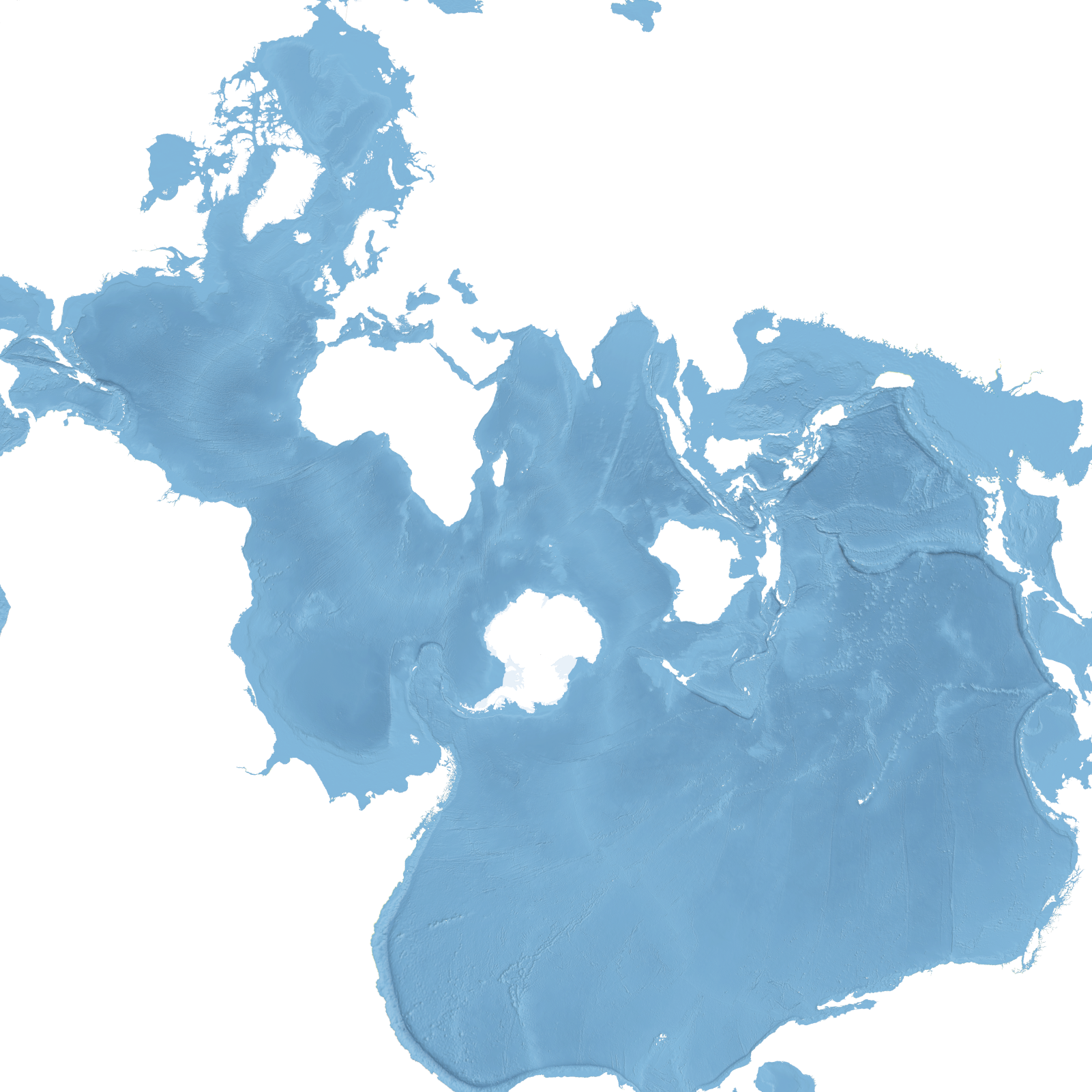
#30DayMapChallenge Day 20: Water
World map using the Spilhaus projection. The oceans form a single mass of water around Antarctica.
#Tag
#30DayMapChallenge Day 20: Water
World map using the Spilhaus projection. The oceans form a single mass of water around Antarctica.
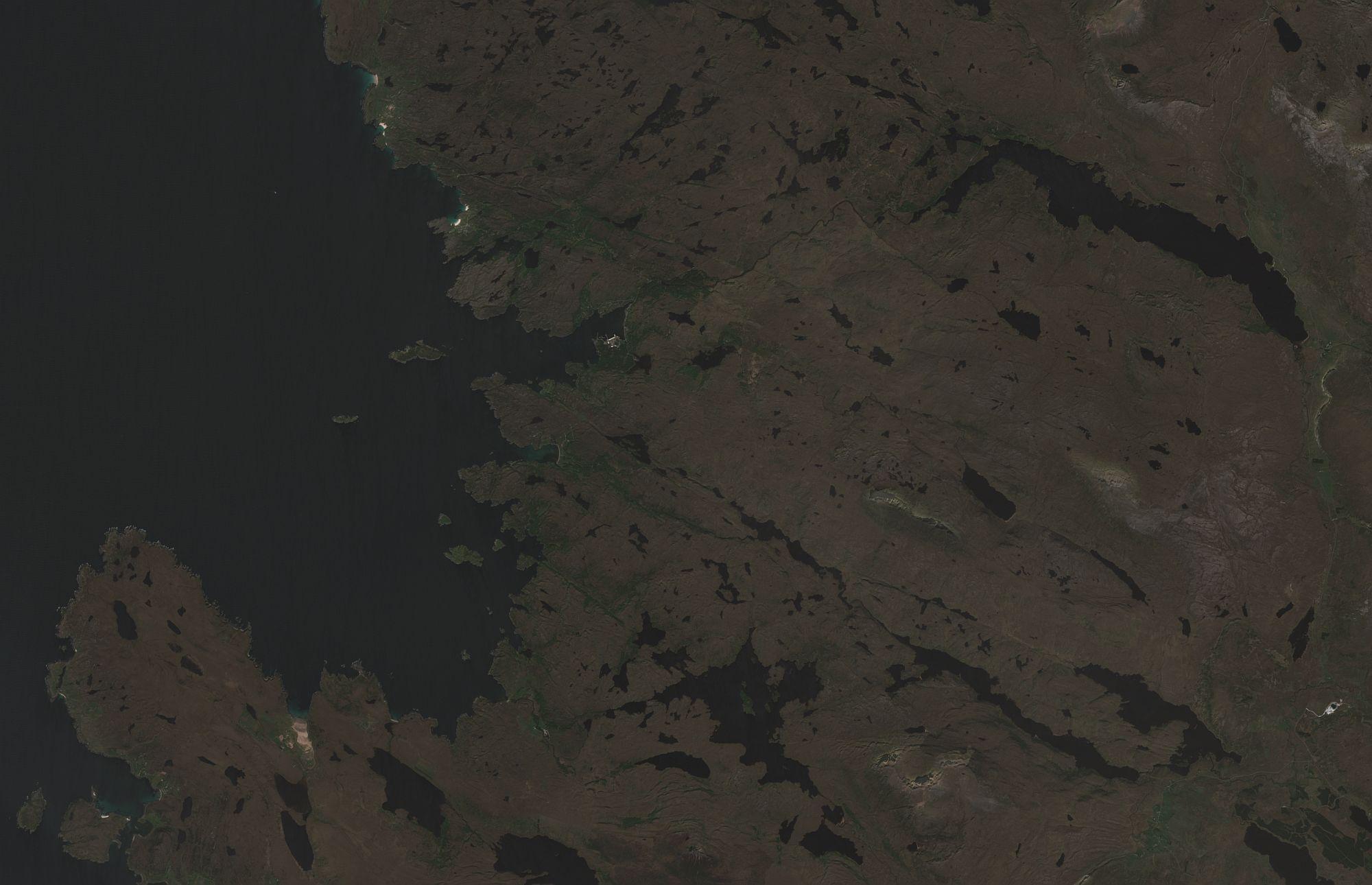
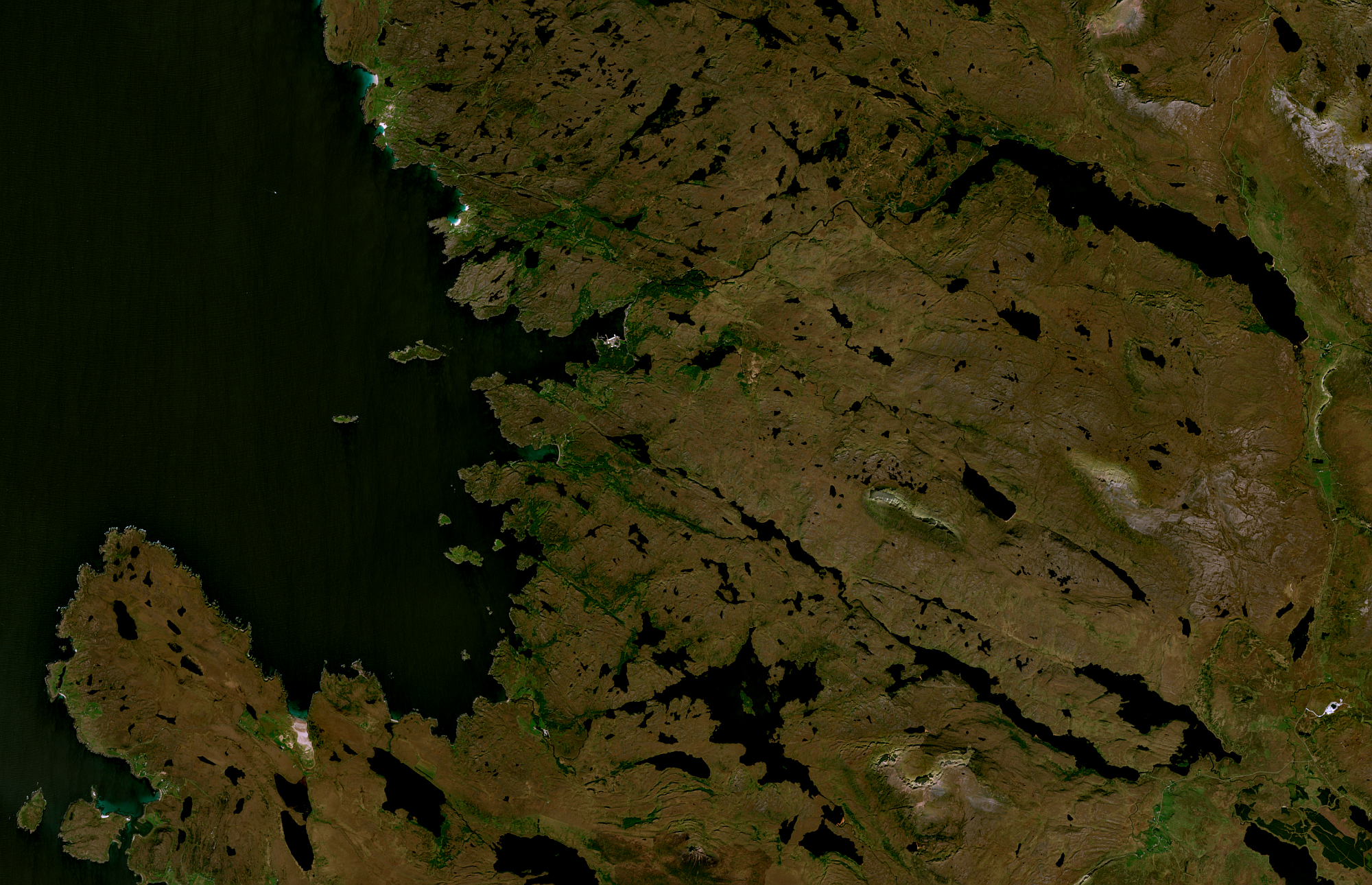
Sentinel-2a rgb satellite image of area around Lochinver in NW Scotland. New tool was using new #gdal application for initial process then #GIMP for colour correction, saturation and sharpness. New discovery that GIMP can save GeoTIFF images. Images show before and after. I think I need to work harder at colour correction - it's too green and still rather dark.
Data downloaded from Copernicus Browser - https://browser.dataspace.copernicus.eu/.
#30dayMapChallenge Day 17: A new tool.
GDAL is not only a tool for handling various geospatial data formats. The new version introduces support for many geoprocessing tools, including:
- raster algebra,
- raster reclassification,
- focal and zonal statistics,
- multi-stage pipelines,
- and much more!
Check out the details here: https://gdal.org/en/release-3.12/programs/index.html#gdal-application (note, this is still experimental).
We have to assume it: most of the potential sponsors for #GDAL are not in Mastodon, but in LinkedIn
@gdal is there as well: https://www.linkedin.com/company/gdalorg