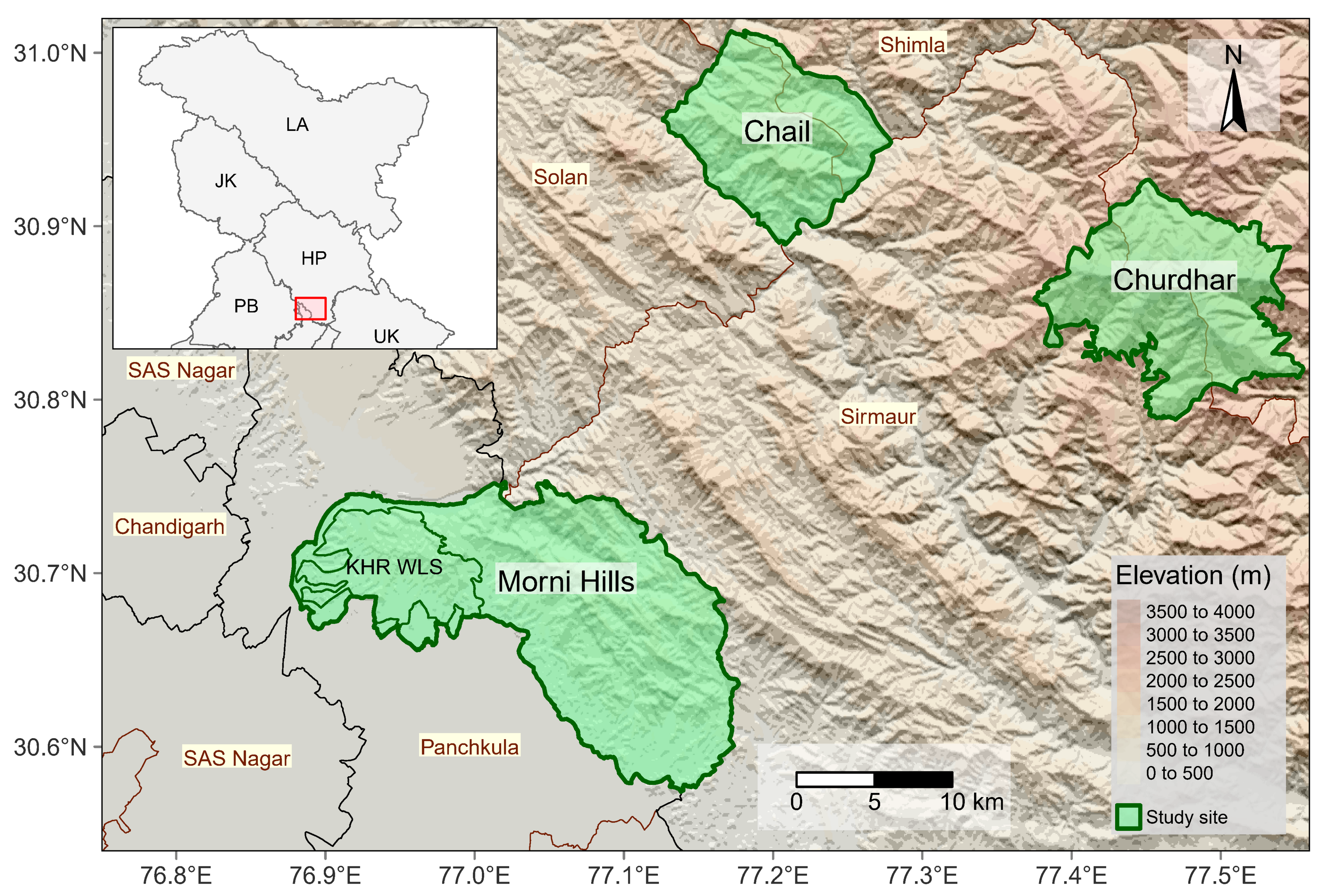
Map showing the locations of three study sites—Morni Hills, Chail Wildlife Sanctuary, and Churdhar Wildlife Sanctuary—across the northwestern Himalayas. The main map depicts topography with shaded elevation ranging from 0 to 4000 meters, where darker shades represent higher elevations. The study sites are outlined in green, with Morni Hills located in Haryana, and Chail and Churdhar in Himachal Pradesh. Surrounding districts, including Panchkula, Sirmaur, Solan, Shimla, and SAS Nagar, are labeled. An inset map in the upper left corner shows the broader regional context within northern India, highlighting the states and union territories of Punjab (PB), Haryana (HR), Himachal Pradesh (HP), Uttarakhand (UK), Jammu and Kashmir (JK), and Ladakh (LA), with a red box indicating the study area’s location. A north arrow and scale bar (0–10 km) are included for orientation.
