Djoerd Hiemstra 🍉
and 3 others
boosted

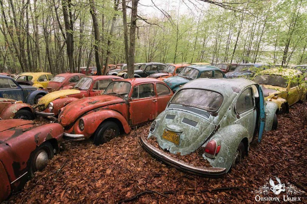
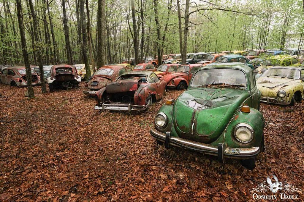
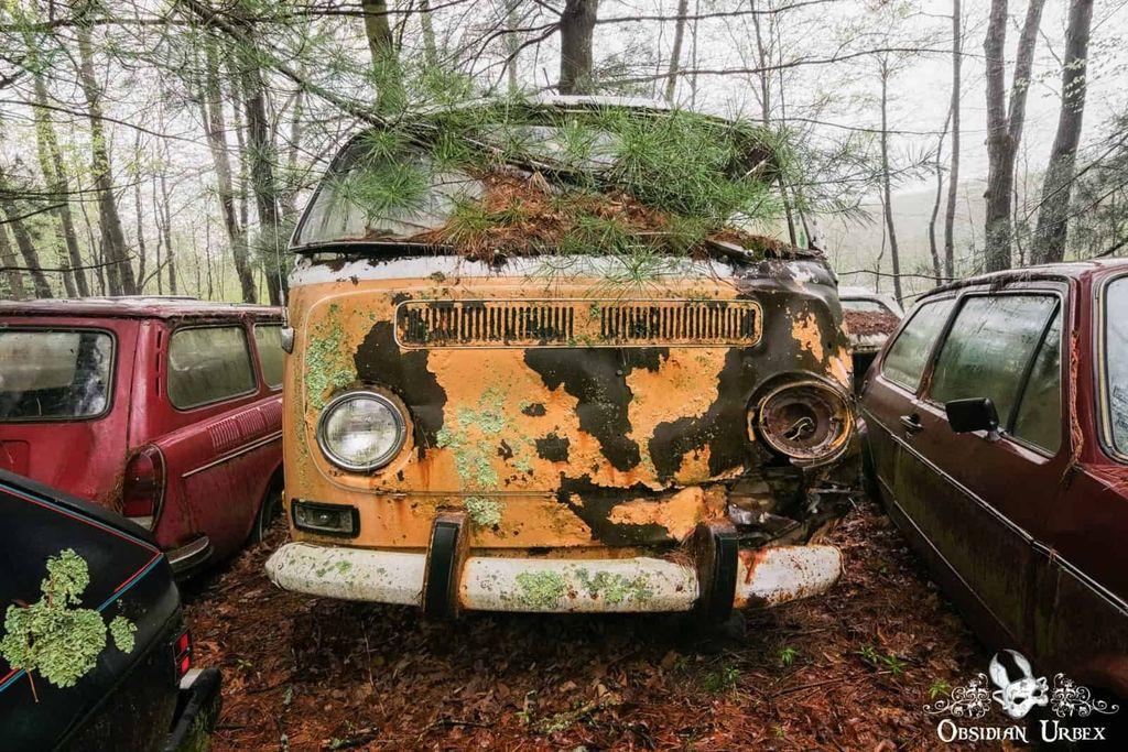
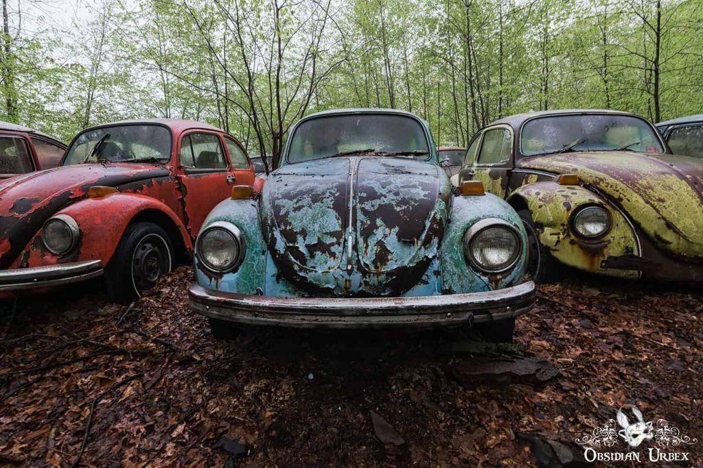
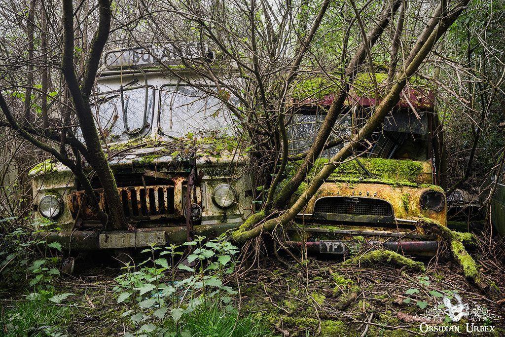
Deep in the woods lies an abandoned VW Beetle Car Graveyard.
Hundreds of Volkswagen Beetles and Bus Campervans are organised into rows and clusters, seemingly based on age and model.
This fleet of rusting rainbow-coloured vehicles appears to represent every colour.
Somewhere in the USA, some years ago.
https://www.obsidianurbexphotography.com/leisure/vw-beetle-car-graveyard-usa/
#USA #America #Abandoned #Photography #OldCars #VW #Volkswagen #Beetle #VWBeetle #Campervan
4 media