Discussion
Loading...

Post

Log in
  • About
  • Code of conduct
  • Privacy
  • Users
  • Instances
  • About Bonfire
Tomo Bacinger
Tomo Bacinger
@tomo@hachyderm.io  ·  activity timestamp last month

Romania

Made with #QGIS and #Blender

#Cartography #Maps #GisChat

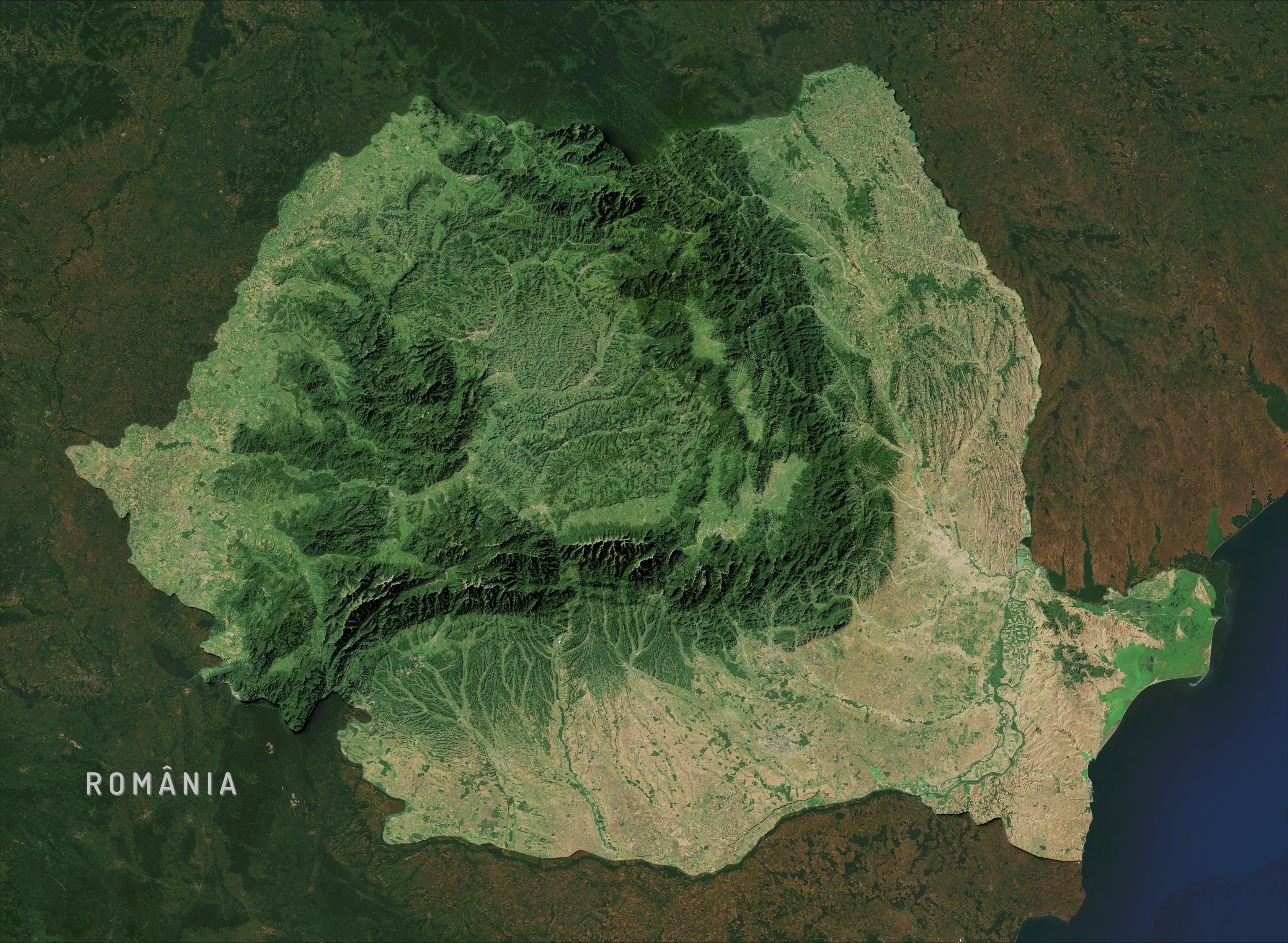
Satellite map of România viewed from space. The country displays its distinctive shape, with the Carpathian Mountains forming a prominent arc across the center, appearing as dark-green, forested ridges. The mountain chain curves like a reversed 'C' or horseshoe, dividing România into three central regions. Inside this arc lies Transylvania, visible as a green elevated plateau. The southern region shows the Wallachian Plain in lighter browns and tans, indicating agricultural lands. The Danube River is visible along the southern border, and the Black Sea coastline appears on the east edge. The mountains show the highest elevations with some snow-capped peaks visible as white spots. The Danube Delta region appears as a distinctive green wetland area where the river meets the Black Sea.
  • Copy link
  • Flag this post
  • Block

bonfire.cafe

A space for Bonfire maintainers and contributors to communicate

bonfire.cafe: About · Code of conduct · Privacy · Users · Instances
Bonfire social · 1.0.1-beta.35 no JS en
Automatic federation enabled
Log in
  • Explore
  • About
  • Members
  • Code of Conduct