Discussion
Loading...

Post

  • About
  • Code of conduct
  • Privacy
  • Users
  • Instances
  • About Bonfire
stevefaeembra
@stevefaeembra@mapstodon.space  ·  activity timestamp last week

Flight down Glencoe, done in a 80s/90s Sci Fi movie style.

Contours done in #QGIS , using data from Ordnance Survey Open ZoomStack

Used a trick to do hidden faces removal 1/2 :)

#Blender

Your browser does not support the video tag.
GIF
GIF
Flight down Glencoe in 3d. The hillside is shown as glowing neon contour lines, in a sci-fi movie style. The flight heads from east to west, banking a couple of times to turn corners.
  • Copy link
  • Flag this post
  • Block
stevefaeembra
@stevefaeembra@mapstodon.space replied  ·  activity timestamp last week

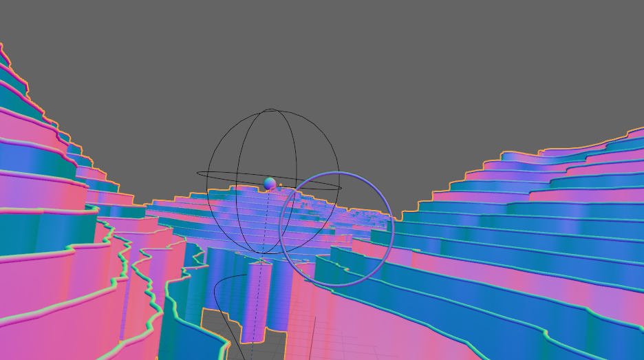
Trick to hidden face removal - do as curves in geometry nodes, then extrude vertically.

The contour lines are rendered in neon, and the vertical extrusions in matt black.

This keeps face counts way down, compared to using a landscape mesh 2/2

screenshot showing contour lines, which planes being extruded downwards. These are used to hide details without needing a landscape mesh
  • Copy link
  • Flag this comment
  • Block
Log in

bonfire.cafe

A space for Bonfire maintainers and contributors to communicate

bonfire.cafe: About · Code of conduct · Privacy · Users · Instances
Bonfire social · 1.0.0-rc.3.21 no JS en
Automatic federation enabled
  • Explore
  • About
  • Members
  • Code of Conduct
Home
Login