Post-LGM intensification of marine faulting: resolution-dependent hazard assessment
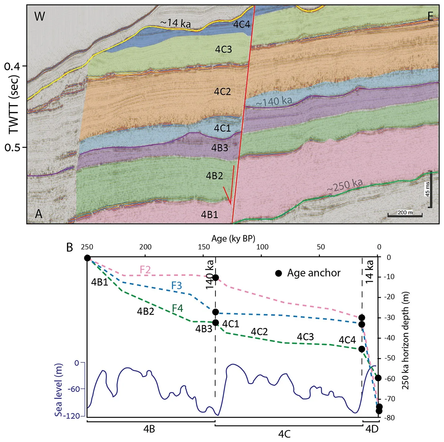
Abstract. In marine environments, site-specific fault hazard assessments conventionally calculate average slip rates by measuring the displacement of the youngest mappable stratigraphic horizon. However, due to data resolution limits, this horizon is typically tens to hundreds of thousands of years old. Consequently, hazard surveys provide long-term averages that may mask recent, non-linear fault behavior. In this study, we examine how increasing stratigraphic resolution affects the calculated slip rates used for offshore seismic design. We investigate thin-skinned normal faults offshore Israel that pose hazards to major pipelines delivering gas to onshore power plants. Previous assessments measuring displacements of a 350 ka horizon yielded average slip rates of 0.25 mm yr−1. However, by utilizing higher-resolution seismic data to measure displacements across a 14 ka horizon, we calculated a recent slip rate of 2.4 mm yr−1. This tenfold increase indicates non-linear slip rates and raises the hypothesis that rapid post-LGM (Last Glacial Maximum) sea-level rise influenced the increased faulting. To examine this, we extended our time window to the latest Pleistocene, thereby demonstrating a correlation between sea-level fluctuations and variations in faulting. The finding that fault slip rates increased after the last glacial period has two main implications. First, it supports the hypothesis that rapid sea-level rise drives increased faulting, possibly due to changes in pore pressure along thin-skinned faults and detachment surfaces, contributing to the understanding of thin-skinned fault mechanics. Second, it suggests the need to use post-LGM stratigraphic horizons as seismic markers for geomarine hazard analysis, particularly in circum-Mediterranean margins where the Messinian salt giant propels salt tectonics.