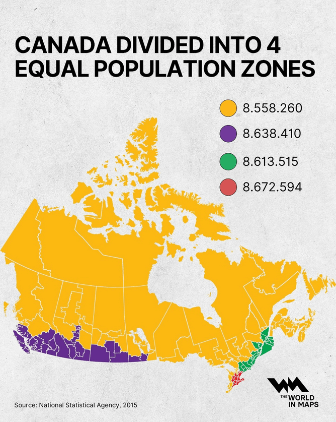
At a glance, Canada looks vast and evenly spread but when you divide the country by population, the picture changes dramatically...
by @the.world.in.maps
At a glance, Canada looks vast and evenly spread but when you divide the country by population, the picture changes dramatically...
by @the.world.in.maps
@infobeautiful Many decades ago (circa 1970) the Queen's Printer created an isodemographic map of Canada using ball bearings and flexible steel splines. The result was gorgeous and informative.
@infobeautiful At a glance perhaps by folk who’ve only spent time along the southern corridor. Canadians who’ve spent time outside that are very aware of this. :)
Not exactly a population density map but close enough.
@infobeautiful is that Toronto in red? I didn’t realize it was so much denser than the other cities
@infobeautiful A wonderful way to look at our Country
@infobeautiful Canada's still vast — and not for sale & annexation, I'm pretty sure! 😎💪✌🇨🇦🇺🇸
@infobeautiful it is wild that California has a larger population than Canada
@infobeautiful and the public transit between the population centers is, as I understand, pretty nonexistent.
@infobeautiful curious to know how heavily weighted the entire yellow section is towards the Atlantic provinces
@infobeautiful I like how the purple spike in Alberta is reaching up to grab Edmonton