Early feedback on the "Sidewalk Location Priority Toolkit" for QGIS is welcome.
Are you interested in something like this? What's helpful to you? Questions?
Early feedback on the "Sidewalk Location Priority Toolkit" for QGIS is welcome.
Are you interested in something like this? What's helpful to you? Questions?
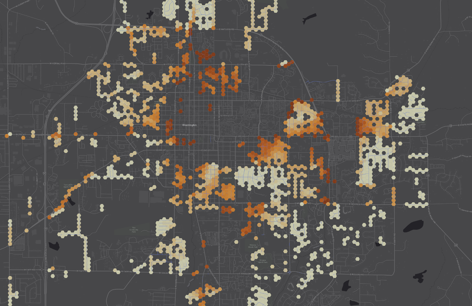
The current iteration of the plugin generates a starter hex grid for you.
The expanded version will support "bring your own hex grid", so you can start with a grid and then continue add more values to it which are then used to build a priority score.
This final step is described more here, in How to Create a Heatmap of Sidewalk Location Priority:
https://mark.stosberg.com/how-to-create-a-heatmap-sidewalk-location-priority/
🧵
Early feedback on the "Sidewalk Location Priority Toolkit" for QGIS is welcome.
Are you interested in something like this? What's helpful to you? Questions?
Another #UrbanPlanning algorithm I plan to pick back up is like "Percent High Comfort BikeShed" (or WalkShed).
The idea is compute the area from a given a location that you bike to within 15 minutes and then the area that bike to *with high comfort*, like protected bike lanes and so forth. Divide them to get the "Percent High Comfort Bikeshed" for that location.
"Percent High Comfort Bikeshed" may be harder to package for #QGIS because it involves running a custom #valhalla server currently-- building a graph to generate the bike isochrones (travel-time area) using only the high-comfort facilities.
If there's a way to query Valhalla such that only a subset of the network is considered for routing, then I could run it against public servers.