Each season I do four nights of moth lighting in my garden in suburban Ōtautahi-Christchurch, NZ. My summer moth lighting this year started on Saturday. I photograph every moth that settles at my light and today I've been uploading my photos to #iNaturalist.
I've been doing this consistently each autumn since 2015 and every season each year since (at least) 2021. You might think I would have found all the moth species that visit my garden, but no.
So far I've finished uploading Saturday's moth photos and have found six new species to our garden. Here are four of them.
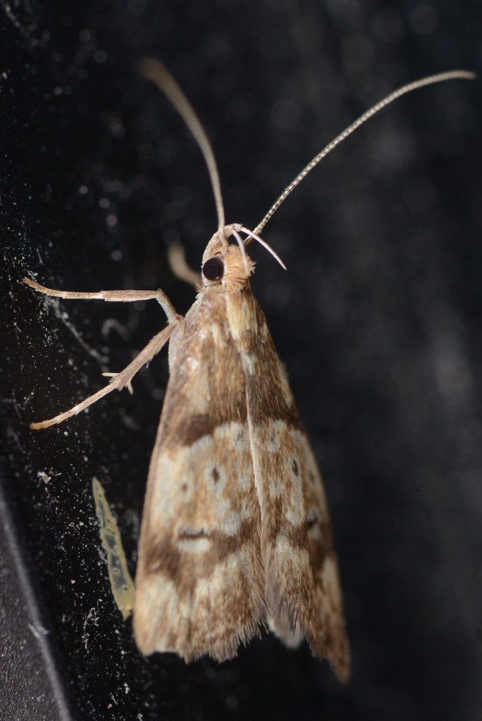
There's the endemic moth *Gymnobathra hamatella*:
https://inaturalist.nz/observations/337290749
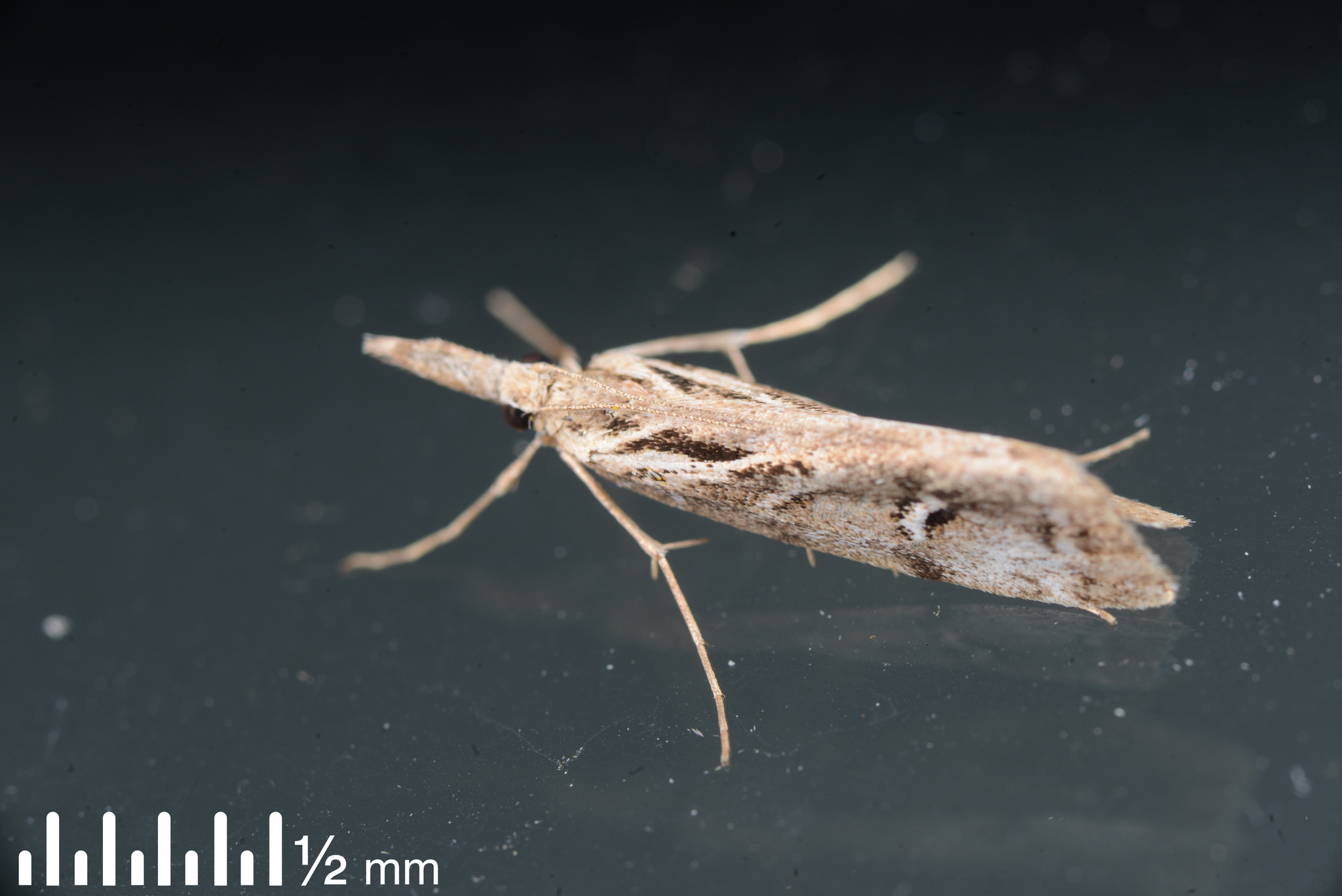
There's the "nationally vulnerable" endemic species *Gadira leucophthalma*:
https://inaturalist.nz/observations/337263605
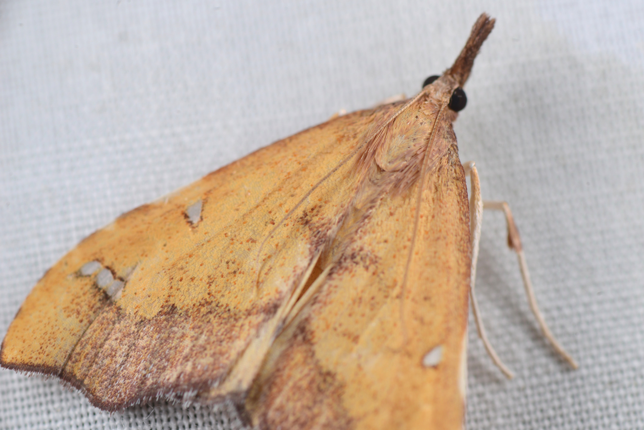
There's the endemic Clematis triangle *Deana hybreasalis*:
https://inaturalist.nz/observations/337285888
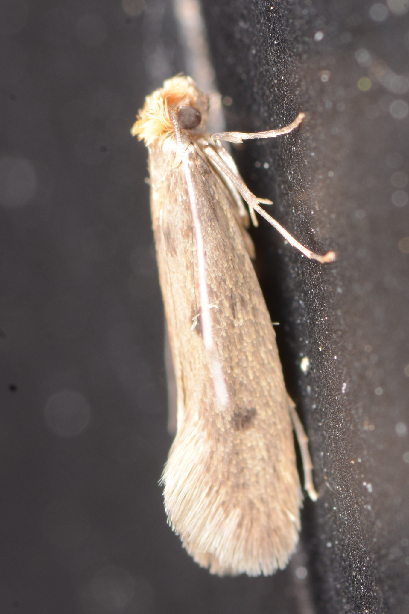
Also, less ideal, there's the introduced Case-bearing Clothes Moth *Tinea pellionella*:
https://inaturalist.nz/observations/337285916
#mothodon #moths #Lepidoptera #Ōtautahi #Christchurch #NZ #insects #EcologicalMonitoring