
RE: https://hachyderm.io/@datarama/117214107554538348
I am *so* here for watching people advocate for their favourite map projections. This might be my favourite type of nerd debate.
Thank you, Fediverse.
(Also: https://xkcd.com/977/)
Discussion
RE: https://hachyderm.io/@datarama/117214107554538348
I am *so* here for watching people advocate for their favourite map projections. This might be my favourite type of nerd debate.
Thank you, Fediverse.
(Also: https://xkcd.com/977/)
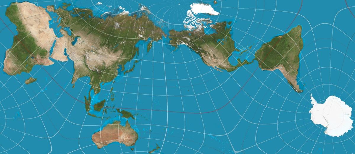
@sundogplanets What's all that white stuff in the middle though? 😐
Y'see I remember deciding as a teenager that Olbers' equal area was best, but I have absolutely no recollection of why.
Why no the Mollweide projection for equal-area cards? It even has the poles..
@sundogplanets @cosmos4u Beeing a sailor this one gives me true nightmares. It however explaines why someone naturally finds the Americas on his way to India…
@sundogplanets I'd have voted against the "Correct the map" resolution because of the title: any projection of a non-Euclidean geometry onto a plane will be distorted in some way. There is no "correct" projection - each gets something wrong, so you just pick one that minimizes the error for whatever it is you are studying at the moment. It sounds like arguing about Schwarzschild coordinates versus Kruskal-Szekeres coordinates when the choice is one of convenience.
@sundogplanets Maps are so outdated.
If you’re not using paper, the software you use should render a globe.
We’re carrying supercomputers in our pockets. These things can easily handle the math necessary to do everything in 3d.
Map projections were necessary back when we did mapping on paper, and we didn’t know what part of the globe someone would be interested in.
With software we can render a globe with the area of interest centred. Zoomed in tight it will look flat. Zoom out enough and it’s a globe. Voila, no more need for terrible projections (and they’re all terrible).
@sundogplanets I'm a particular fan of Hajime Narukawa's AuthaGraph projection, which divides the globe into 96 equal triangles, maps them onto a tetrahedron then unfolds them into a rectangle!
As you might imagine, it looks bizarre when you're used to the Mercator, but it does preserve the true size ratios between land and water far better than most other projections.
@sundogplanets my personal favorite happens to have been my great grandfather‘s invention… https://www.map-projections.net/single-view/briesemeister-v2
@sundogplanets Baseball in a cup in it's side (Universal Transverse Mercator) for north-south aligned areas of interest where you need to keep distance distortions low and traffic cone on a basketball (Lambert Conformal Conic) for east-west. Engineers and surveys still need to turn angles and travel distances to land navigate and distance distortions are easy to correct. Where the sportsball intersects the container there are no distance distortions, nearby they are small enough to ignore.
@sundogplanets I'm partial to the Kavrayskiy VII projection.
@sundogplanets My favorite map projection is
@sundogplanets the ultimate goal is to hang a good Dymaxion projection map on the wall of my Dymaxion house... which likely has no flat walls...hmmm

Install bonfire.cafe
Get the full app experience