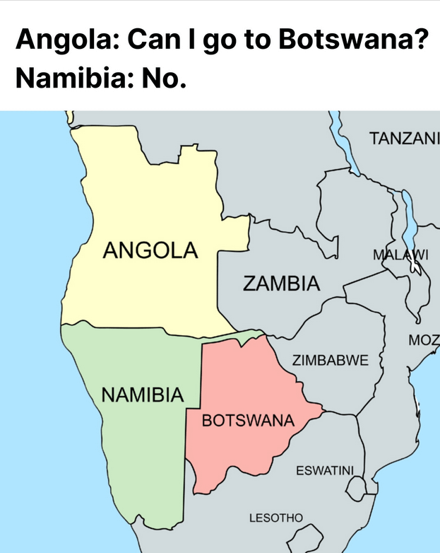
A humorous map meme titled “Angola: Can I go to Botswana? Namibia: No.” showing part of southern Africa with countries colored to illustrate the joke. Angola appears in pale yellow at the upper left of the region labeled ANGOLA, Namibia is directly below it colored light green and labeled NAMIBIA, and Botswana is to the east colored pink and labeled BOTSWANA. Surrounding countries such as Zambia, Zimbabwe, Tanzania, Malawi, Mozambique, Eswatini, and Lesotho are shown in gray with their names marked but not highlighted. The map makes clear that Angola and Botswana do not share a border because Namibia lies between them, with Namibia forming a long vertical strip along the Atlantic coast that blocks Angola from directly reaching Botswana, which is the geographic basis of the joke that Namibia is saying “no” to Angola’s request to go there. The background ocean along the west coast is light blue and the map uses simple borders and flat colors to emphasize the spatial relationship between the three countries.