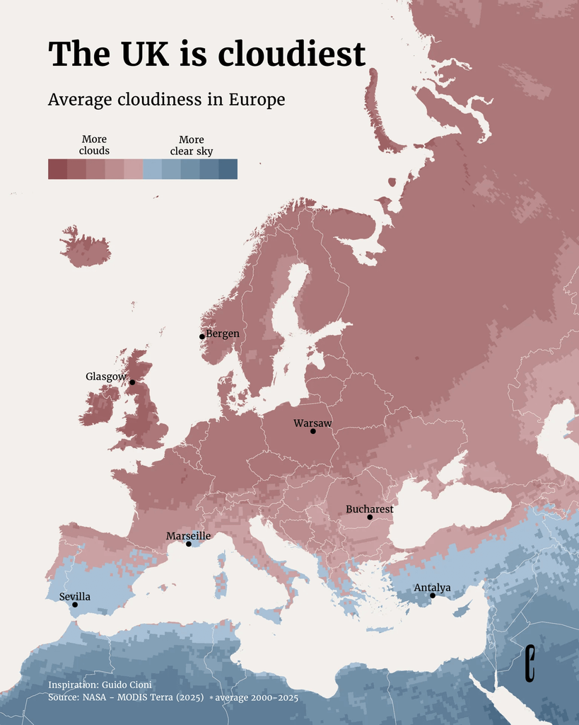
The Cloudiest Place
https://europeancorrespondent.com/en/r/the-cloudiest-place
by Instagram user: @theeuropeancorrespondent
Post
The Cloudiest Place
https://europeancorrespondent.com/en/r/the-cloudiest-place
by Instagram user: @theeuropeancorrespondent
@infobeautiful I don't know - it looks to me like Eire is proportionally more "dark red" than the UK...
@infobeautiful
According to the alt text, Bucharest is in blue…
Compare this with long distance flight routes 😉

Install bonfire.cafe
Get the full app experience