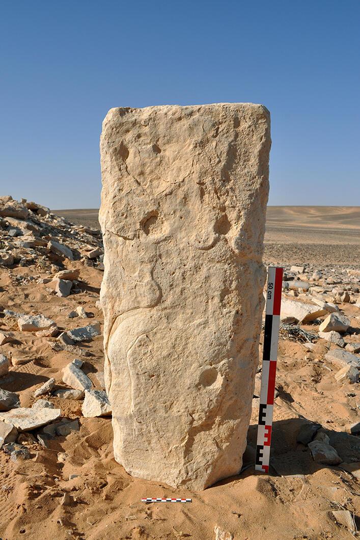
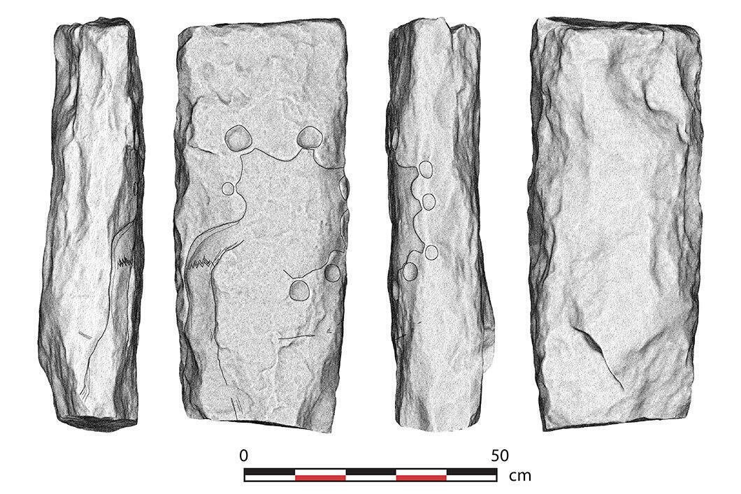
#map The oldest map ever drawn, dating back to 9,000 years and discovered in Jordan. The ‘Jibal al-Khashabiyeh engraved stone’ depicts a ‘desert kite’, a hunting device used in the Middle East during the Neolithic. The maps was drawn on a 92 kg limestone block nearly 80 cm high using a stone tool. The block was recovered in 2015, and the results of the analyses were published in 2023 in the journal PLOS ONE
Original article: https://journals.plos.org/plosone/article?id=10.1371/journal.pone.0277927
An aerial view of the desert kit represented in the monolith map. It shows a vast enclosure and, on the periphery, the small pits of the kite. The landscape is monochromatic, dominated by shades of light brown, tan, and beige, when the ground texture is rough and uneven, scattered with small rocks, gravel, and scrub. A graphical scale bar is visible in the bottom left corner, marking increments of 0, 50, and 100 meters.
A 3D model of the monolith engraved with the oldest map ever drawn. 4 four different columns represent different angles of the monolith. An interpretative sketch, mainly visible in the 2nd centre left column, has been drawn by researchers. It’s a complex geometric shape representing a ‘desert kite’, structured as a corridor (at the bottom of the monolith) leading up to a large enclosure that opens onto several pits (small round shapes in the drawing). The 3D model is represented in a stippled (dot-based) shading technique, emulating the rough texture of the stone in greyscale, while the interpretative sketch is highlighted with black outlines.
A photograph of the monolith engraved with the oldest map ever drawn. It’s a substantial rectangular pillar with a weathered, porous surface characteristic of limestone, and it's standing upright in an arid, desert landscape. A red and white metric scale ruler is positioned alongside for size reference.