Discussion
Loading...

Post

  • About
  • Code of conduct
  • Privacy
  • Users
  • Instances
  • About Bonfire
Tim Sherratt
@wragge@hcommons.social  ·  activity timestamp 2 days ago

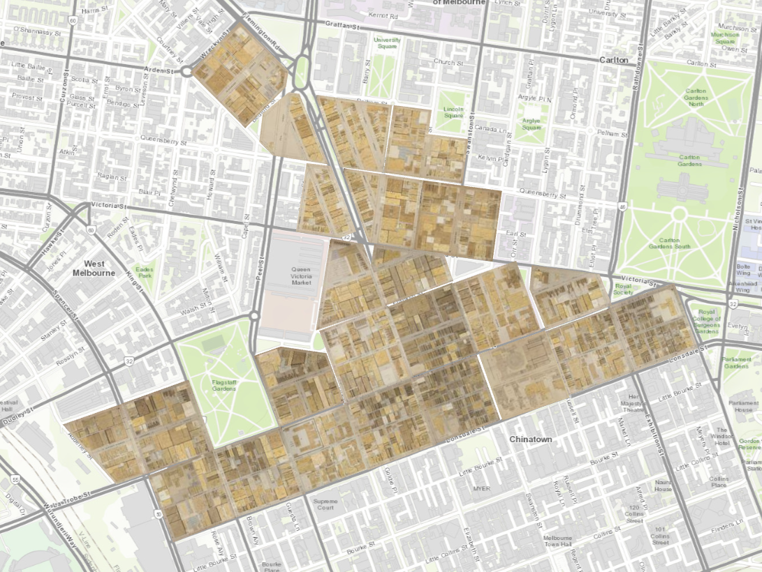
I've been playing with AllMaps to georeference SLV maps that are available via @IIIF. Here's a set of maps of the Melbourne CBD created for fire insurance in the 1920s. https://viewer.allmaps.org/?url=https%3A%2F%2Fannotations.allmaps.org%2Fmanifests%2F628c216109f482f1 Hold down 'b' to remove the map backgrounds & see the buildings more easily. #GLAM #libraries #digitalHumanities #maps

Screenshot of AllMaps viewer showing a series of historic maps overlaid on a modern basemap.
  • Copy link
  • Flag this post
  • Block
Tim Sherratt
@wragge@hcommons.social replied  ·  activity timestamp 2 days ago

Here's the catalogue entry: https://find.slv.vic.gov.au/permalink/61SLV_INST/1sev8ar/alma9920645823607636

  • Copy link
  • Flag this comment
  • Block
Log in

bonfire.cafe

A space for Bonfire maintainers and contributors to communicate

bonfire.cafe: About · Code of conduct · Privacy · Users · Instances
Bonfire social · 1.0.0-rc.3.13 no JS en
Automatic federation enabled
  • Explore
  • About
  • Members
  • Code of Conduct
Home
Login