Discussion
Loading...

Discussion

  • About
  • Code of conduct
  • Privacy
  • Users
  • Instances
  • About Bonfire
Mario Restuccia
@mario@eupolicy.social  ·  activity timestamp 3 weeks ago

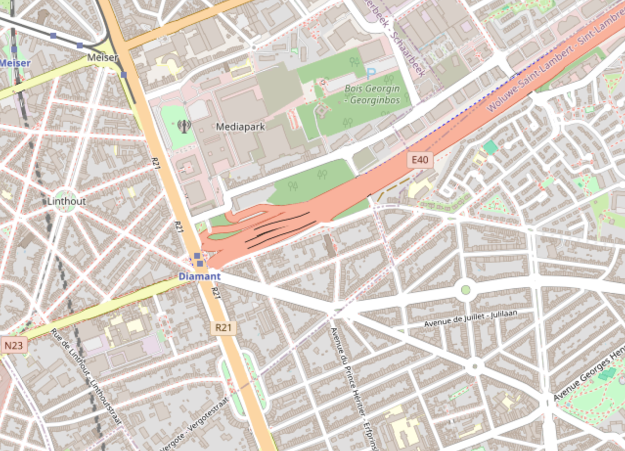
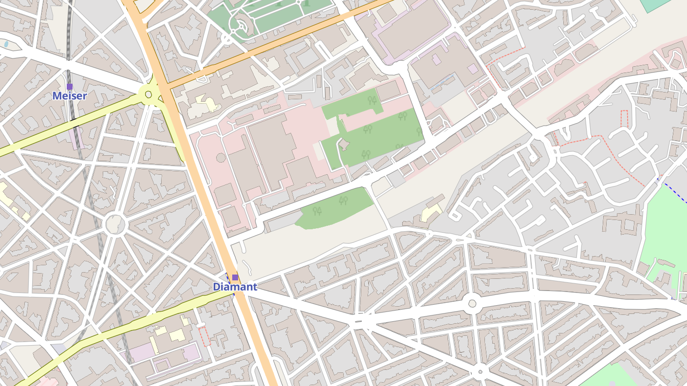
I'm still obsessed with the idea of finding a #map designed for humans instead of cars.

Take these screenshots from Brussels: in the default #openstreetmap view, the highway is big and red.
If you remove it, as I tried with MapTiler, the area is simply grey: not for humans, not for bikes, so there is no need for it to be clearly visible. The result has less clutter and it's more pleasant.

Are there any map services designed for humans, where car infrastructure is simply hidden?

The same map, but the highway is simply grey, the result is less visual clutter
A map showing a big red set of lines, a highway
  • Copy link
  • Flag this post
  • Block
maeool
@maeool@mastodon.social replied  ·  activity timestamp 2 weeks ago

@mario not perfect in cartes.app (should we go further ? It's also important to tell the user : you won't be able to cross this shit) but it's less red ;)

https://cartes.app/#16.05/50.851608/4.40631

Sorry, no caption provided by author
  • Copy link
  • Flag this comment
  • Block
Mario Restuccia
@mario@eupolicy.social replied  ·  activity timestamp 3 weeks ago

I wish the default @openstreetmap or platforms such as @cartes_app or @CoMaps could implement something like this.

Sadly, the default trend, as imposed by Google/Apple maps, is that maps are designed for car users. So you get roads that are more visible if they have more lanes, if they allow cars to drive faster. Highways are big and red. Urban roads are orange or yellow if they allow for more traffic. Bike lanes? Not shown by default.

  • Copy link
  • Flag this comment
  • Block
Mer-fOKxTOwl
@glowl@chaos.social replied  ·  activity timestamp 3 weeks ago

@mario @openstreetmap @cartes_app @CoMaps

i would argue that they can be used as orientation guides because they are almost impossible to miss. but yes, a map rendering where they are a lot less emphasized and bike/pedestrian infrastructure is easier to see would be really great.

#osm

  • Copy link
  • Flag this comment
  • Block
Log in

bonfire.cafe

A space for Bonfire maintainers and contributors to communicate

bonfire.cafe: About · Code of conduct · Privacy · Users · Instances
Bonfire social · 1.0.1-alpha.8 no JS en
Automatic federation enabled
  • Explore
  • About
  • Members
  • Code of Conduct
Home
Login