Discussion
Loading...

Discussion

  • About
  • Code of conduct
  • Privacy
  • Users
  • Instances
  • About Bonfire
Mark Stosberg
@markstos@urbanists.social  路  activity timestamp yesterday

#QGIS supports a "Model builder" that will allow you to chain a selection of these algorithms together with data you have.

At the end of the pipeline, you can give weights to each of the component pieces for a final priority that balances safety, utility and equity in sidewalk planning!

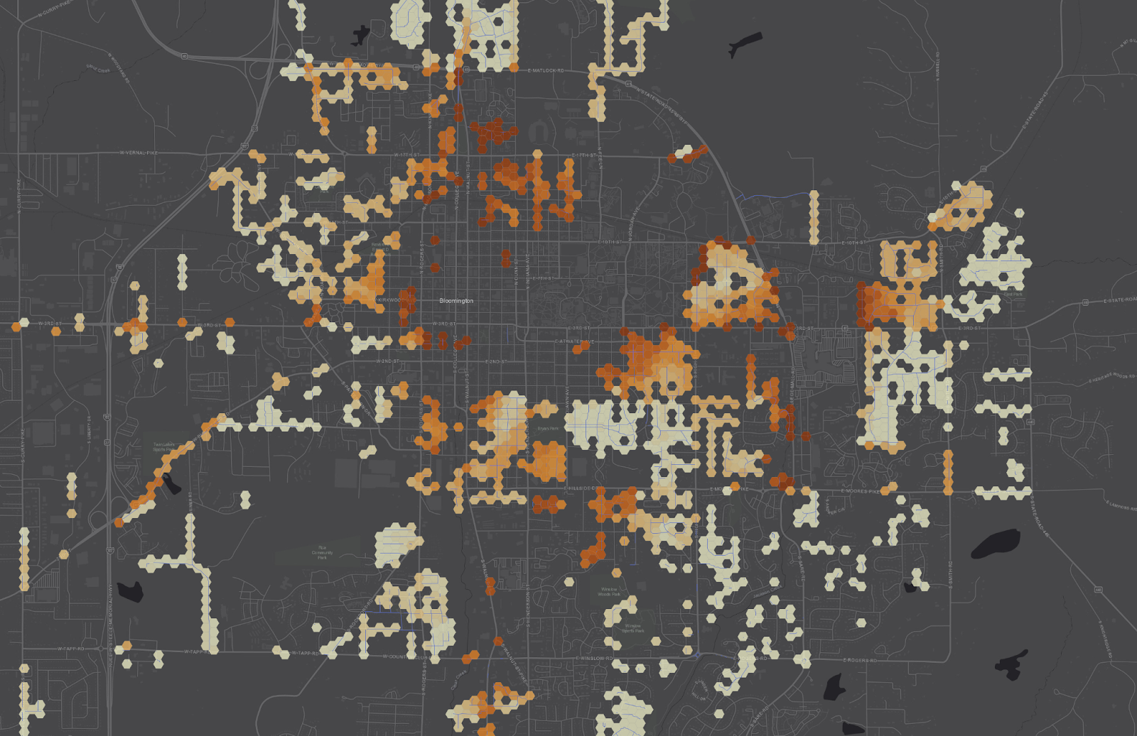
Here's a heatmap of locations with missing sidewalk, shaded based on priority to fund. 馃У

#UrbanPlanning #Mapping

Hexagon Heatmap of missing sidewalk locations
  • Copy link
  • Flag this post
  • Block
Mark Stosberg
@markstos@urbanists.social replied  路  activity timestamp yesterday

The current iteration of the plugin generates a starter hex grid for you.

The expanded version will support "bring your own hex grid", so you can start with a grid and then continue add more values to it which are then used to build a priority score.

This final step is described more here, in How to Create a Heatmap of Sidewalk Location Priority:

https://mark.stosberg.com/how-to-create-a-heatmap-sidewalk-location-priority/

馃У

#QGIS #Mapping #UrbanPlanning

Mark Stosberg

How to Create a Heatmap of Sidewalk Location Priority

Your city has an incomplete sidewalk network. The budget to build new sidewalks is limited. Which sidewalks should prioritized to build next in a way that is objective, 聽transparent and improves transportation equity? Here's how to build to heatmap of locations to prioritize to build sidewalks, based on spatial analysis
  • Copy link
  • Flag this comment
  • Block
Mark Stosberg
@markstos@urbanists.social replied  路  activity timestamp yesterday

Early feedback on the "Sidewalk Location Priority Toolkit" for QGIS is welcome.

Are you interested in something like this? What's helpful to you? Questions?

#QGIS #Mapping #UrbanPlanning

  • Copy link
  • Flag this comment
  • Block
Mark Stosberg
@markstos@urbanists.social replied  路  activity timestamp yesterday

Another #UrbanPlanning algorithm I plan to pick back up is like "Percent High Comfort BikeShed" (or WalkShed).

The idea is compute the area from a given a location that you bike to within 15 minutes and then the area that bike to *with high comfort*, like protected bike lanes and so forth. Divide them to get the "Percent High Comfort Bikeshed" for that location.

https://urbanists.social/@markstos/113215939607917305

  • Copy link
  • Flag this comment
  • Block
Mark Stosberg
@markstos@urbanists.social replied  路  activity timestamp yesterday

"Percent High Comfort Bikeshed" may be harder to package for #QGIS because it involves running a custom #valhalla server currently-- building a graph to generate the bike isochrones (travel-time area) using only the high-comfort facilities.

If there's a way to query Valhalla such that only a subset of the network is considered for routing, then I could run it against public servers.

#qgis #mapping #OpenStreetMap

  • Copy link
  • Flag this comment
  • Block
Log in

bonfire.cafe

A space for Bonfire maintainers and contributors to communicate

bonfire.cafe: About 路 Code of conduct 路 Privacy 路 Users 路 Instances
Bonfire social 路 1.0.0 no JS en
Automatic federation enabled
  • Explore
  • About
  • Members
  • Code of Conduct
Home
Login