

"a non-euclidean horror wreaking spatio-temporal havoc" is an accurate way of describing why a paddock marked on a map has different areas in different years.
6
Replies
1
Boost
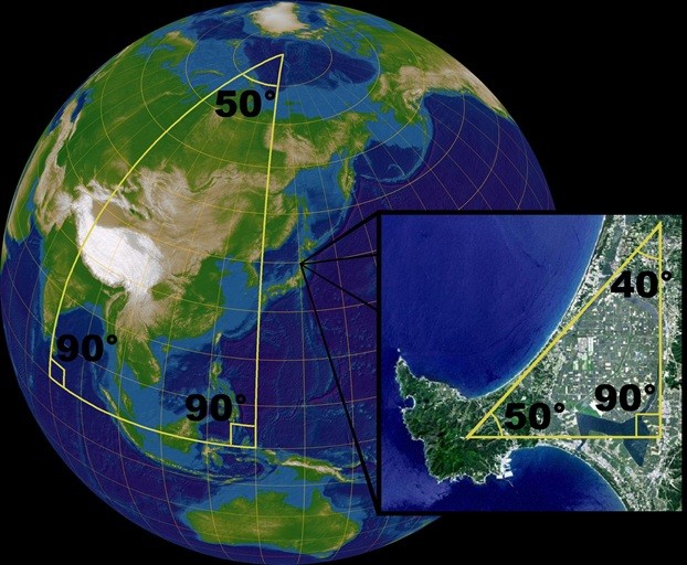
"non-Euclidean geometry" is (loosely!) geometry not on a flat plane. in the picture, you can see that the internal angles of the triangle on the sphere add up to 230° instead of the inset image showing a triangle on a flat plane with angles = 180°
this is a problem calculating the area of polygons on the earth because even a square paddock isn't "length times height" because you have to factor in the curvature of the earth.
we use coordinate reference systems (CRS) to map the Earth, you may know "latitude and longitude" (WGS84). that is a generalised CRS for the whole planet, known to get more inaccurate towards the poles & after 1984.
there are thousands of CRS, specialised for specific regions and points in time (think continental drift).
incorrect CRS use and conversion can lead to accurately measuring a paddock being "a non-euclidean horror wreaking spatio-temporal havoc"