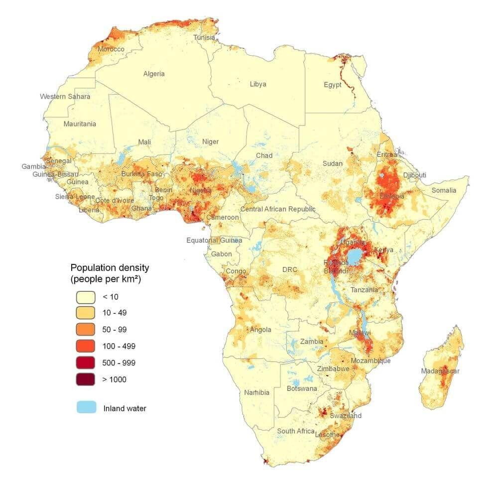
Information Is Beautiful @infobeautiful@vis.social · activity timestamp 2 hours ago Africa population density - very revealing map.110m people in Egypt, 117m in Ethiopia, Nigeria 227m!(via reddit) Read more Read less Translate alt A map of Africa showing population density. The map is color-coded to represent different population density levels, ranging from less than 10 people per square kilometer to over 1000 people per square kilometer. The map highlights areas of high population density, such as the Nile River valley and the coast of West Africa, as well as regions with low population density, such as the Sahara Desert and the Kalahari Desert. A map of Africa showing population density. The map is color-coded to represent different population density levels, ranging from less than 10 people per square kilometer to over 1000 people per square kilometer. The map highlights areas of high population density, such as the Nile River valley and the coast of West Africa, as well as regions with low population density, such as the Sahara Desert and the Kalahari Desert. Reply Boost or quote Boost Quote You cannot quote this post Like More actions Copy link Flag this post Block
alt A map of Africa showing population density. The map is color-coded to represent different population density levels, ranging from less than 10 people per square kilometer to over 1000 people per square kilometer. The map highlights areas of high population density, such as the Nile River valley and the coast of West Africa, as well as regions with low population density, such as the Sahara Desert and the Kalahari Desert. A map of Africa showing population density. The map is color-coded to represent different population density levels, ranging from less than 10 people per square kilometer to over 1000 people per square kilometer. The map highlights areas of high population density, such as the Nile River valley and the coast of West Africa, as well as regions with low population density, such as the Sahara Desert and the Kalahari Desert.