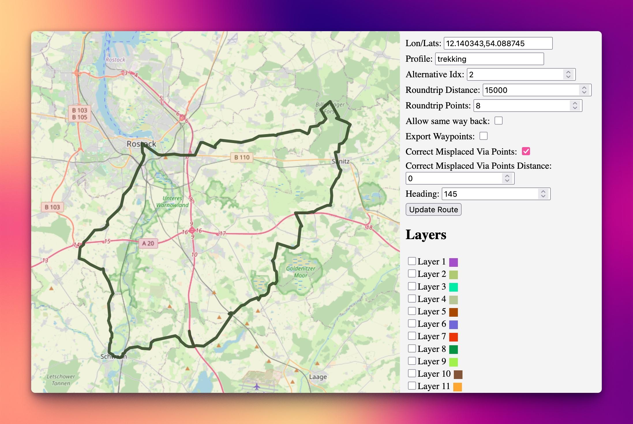
The image appears to be a screenshot of a map application or software interface. The map is centered around the area of Rostock, Germany, as indicated by the city name and surrounding roads and geographical features. The map is overlaid with a black line that seems to outline a route for trekking activity, as indicated by the text "Profile: trekking" in the interface.
The interface includes several fields and options:
1. **Lon/Lats**: Coordinates (12.140343, 54.088745) are displayed, which are the geographical coordinates of the map's center.
2. **Profile**: Set to "trekking."
3. **Alternative Idx**: Set to 2.
4. **Roundtrip Distance**: Set to 15000.
5. **Roundtrip Points**: Set to 8.
6. **Allow same way way back**: This option is unchecked.
7. **Export Waypoints**: This option is unchecked.
8. **Correct Misplaced Via Points Distance**: This option is checked.
9. **Heading**: Set to 145.
Below the map, there is a list of layers that can be toggled on or off, with each layer having a corresponding color. The layers are labeled as Layer 1 through Layer 11, each with a unique color associated with it.
At the bottom of the interface, there is a button labeled "Update Route," which likely updates the route based on the current settings and map data. The interface seems to be designed for planning and managing routes, possibly for trekking or other outdoor activities.