Discussion
Loading...

Post

Log in
  • About
  • Code of conduct
  • Privacy
  • Users
  • Instances
  • About Bonfire
Jérôme Herbinet | FLOSS
@jerome_herbinet@pouet.chapril.org  ·  activity timestamp 4 months ago

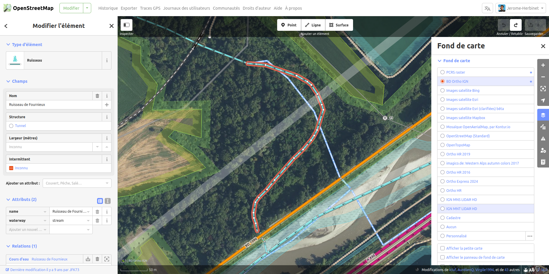
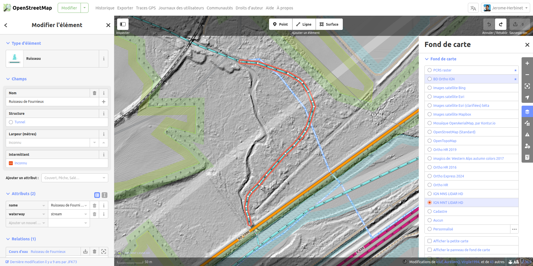
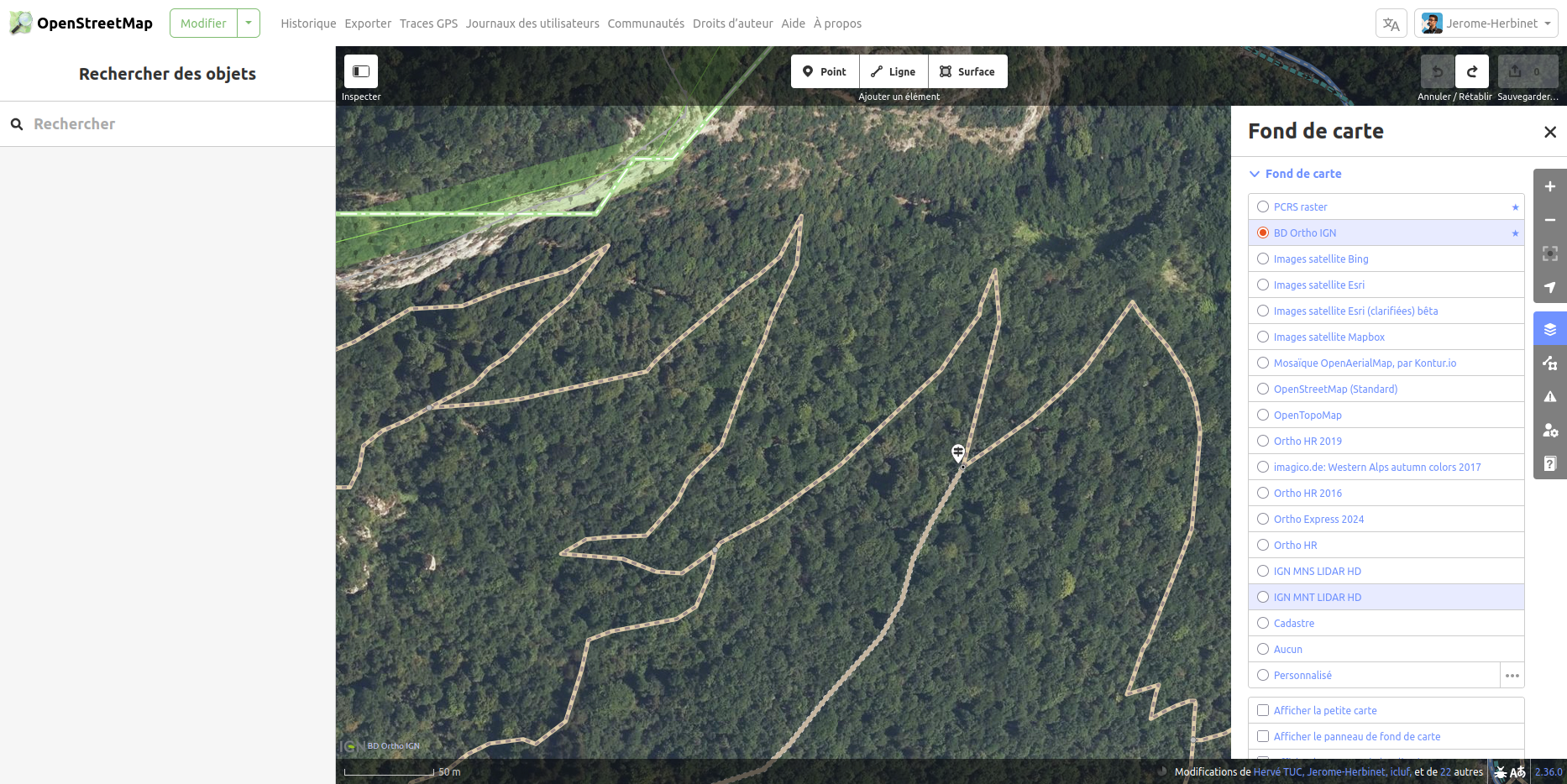
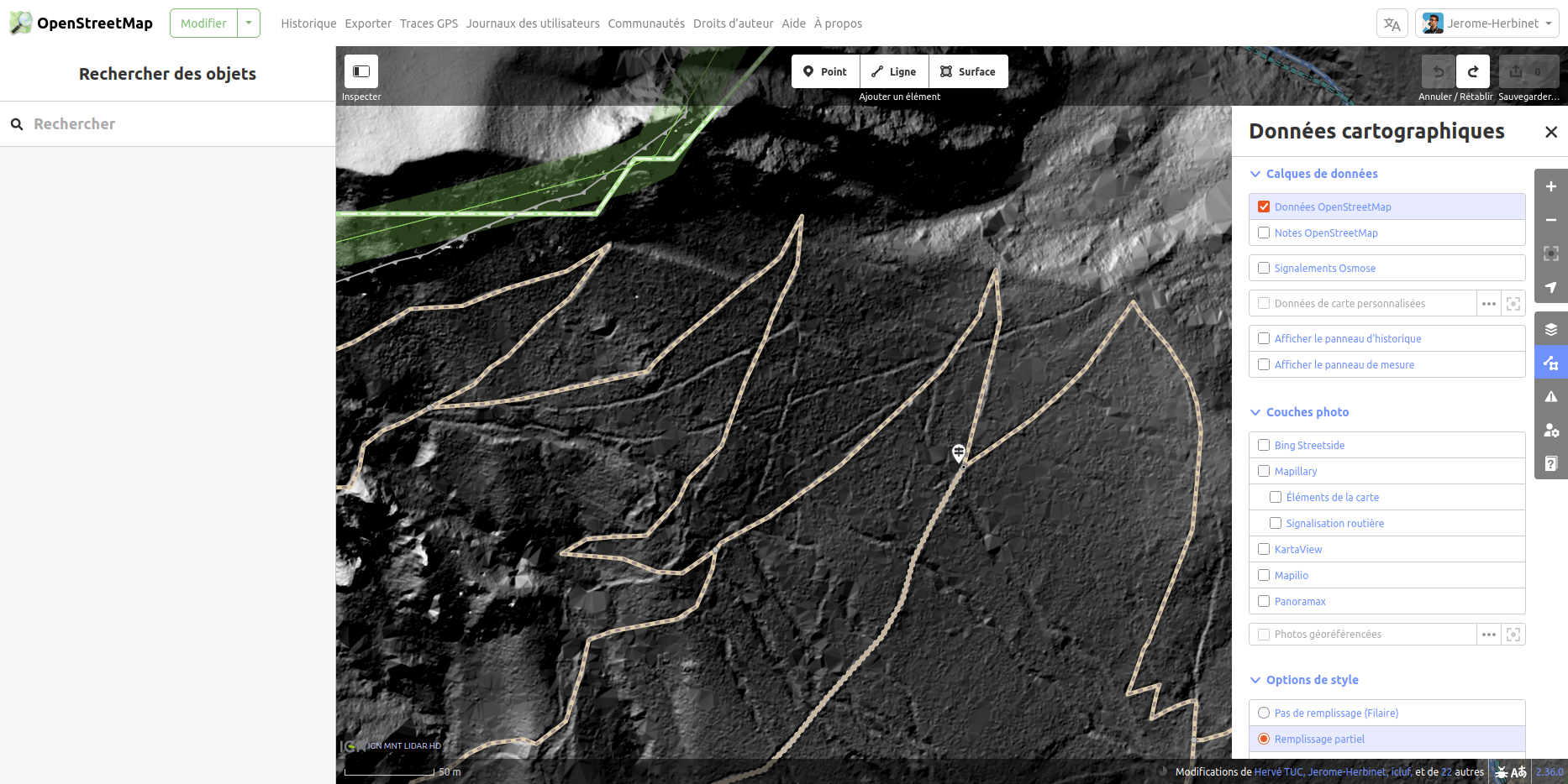
💡 Amis contributeurs d'#OpenStreetMap, connaissez-vous le #LIDAR ? C'est une technologie de télédétection par laser permettant, depuis un avion 🛩️, de créer une carte 3D très précise du terrain, même sous la végétation 🌳

🚀 Grâce à cette imagerie, vous pourrez tracer ou corriger / compléter le tracé de pistes, chemins, et cours d'eau qui sont habituellement masqués par mère nature.

👨‍💻 Le LIDAR est accessible dans l'éditeur ID. Pas vérifié dans #JOSM.

#️⃣ #OpenSource#LogicielsLibres#OSM#IGN

Sorry, no caption provided by author
  • Copy link
  • Flag this post
  • Block

bonfire.cafe

A space for Bonfire maintainers and contributors to communicate

bonfire.cafe: About · Code of conduct · Privacy · Users · Instances
Bonfire social · 1.0.1-alpha.44 no JS en
Automatic federation enabled
Log in
  • Explore
  • About
  • Members
  • Code of Conduct