Discussion
Loading...

Post

Log in
  • About
  • Code of conduct
  • Privacy
  • Users
  • Instances
  • About Bonfire
AkaSci 🛰️
AkaSci 🛰️
@AkaSci@fosstodon.org  ·  activity timestamp 8 months ago

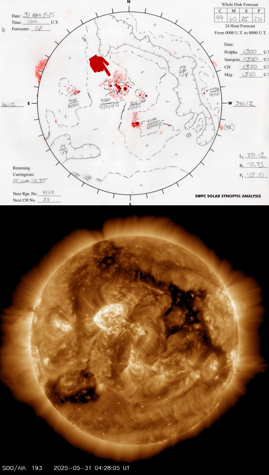
The strong solar flare and CME last night are associated with region 4100 facing Earth as shown in the (hand-drawn!) Solar Synoptic Map published daily by NASA/NOAA SWPC.

An image of the Sun taken by the NASA Solar Dynamics Observatory (SDO) around 04:28 UTC, shortly after the start of the eruption, is shown below.

https://www.swpc.noaa.gov/products/solar-synoptic-map
Video/animation of Sun SDO data around the eruption time at https://sdo.gsfc.nasa.gov/data/latest48.php?q=0193
#SolarStorm
2/n

1. Map of the earth-facing Sun (Solar Synoptic Map) with active regions marked and named
2. Image of the Sun from the NASA SDO spacecraft around the time of the eruption
1. Map of the earth-facing Sun (Solar Synoptic Map) with active regions marked and named 2. Image of the Sun from the NASA SDO spacecraft around the time of the eruption
  • Copy link
  • Flag this post
  • Block

bonfire.cafe

A space for Bonfire maintainers and contributors to communicate

bonfire.cafe: About · Code of conduct · Privacy · Users · Instances
Bonfire social · 1.0.1 no JS en
Automatic federation enabled
Log in
  • Explore
  • About
  • Members
  • Code of Conduct