

ahhhhh what is the map to use when you want to easily link to a specific location with a specific view? bc it ain't #OSM (love OSM btw)
Discussion
Loading...
Discussion

@douginamug @yala @liaizon @piwi @jamesderrick
I’m amazed nobody in this thread has mentioned https://osmapp.org @osmapp yet.
It could be improved - the layer you’re looking at isn’t currently part of the URL. But it generally gets the job done. And it’s actually intended for end users - unlike osm.org 😉


@douginamug
You mean uMap?
@yala thanks for reminding me, def good if it's for multiple points, i.e. creating a new map.


@douginamug have you played with @cartes_app lately?
@liaizon @cartes_app very cool! Excited for multilang!
@liaizon @douginamug @cartes_app
Qu'est-ce qui c'passe? Alors! C'est trop bien.
The copy button only catches the URL part before the hash fragment of the viewport and zoom:
https://cartes.app/?clic=52.4598%7C13.52
It's remarkably simple, the whole Cartes thing. Could actually be nice to internationalise it, but no.
What a nice way to restrict the maintenance burden of FLOSS, just keeping it to a single language community:
- https://codeberg.org/cartes/web/issues/574
Sent from https://cartes.app/?clic=52.4598%7C13.5200#18.98/52.4597018/13.5197866

@yala @douginamug @cartes_app they already announced they are going to translate it or make it so its translatable, I think they even got some nlnet funding? for this, but yeah that will take a while
@liaizon
Thanks for noting. Oh, I didn't scroll down in the issue. Someone should update the OP ;)
@douginamug @cartes_app
@douginamug
Yo. I like to just send the OSM node links as stable identifiers.
Maybe there are frontends that allow to display a node by its ID, but in a nicer map.
@yala yep! I was doing that. But in cases where there is only a path, no node, you can't see the path when you zoom out. So then you're forced to link to an "incorrect" node... not a huge deal, but I like precision


@douginamug Panoramax ? https://api.panoramax.xyz/?date_from=2023-01-01&focus=pic&map=11.81/45.758/4.85899&pic=bc771ada-8da0-4dd4-ba19-a4c1d715bc24&speed=250&theme=default&xyz=5.92/-31.52/30
Still not worldwide coverage but you can upload your own pictures. Flat or 360°
@piwi not what I'm looking for, but very cool! Amazing coverage in France.


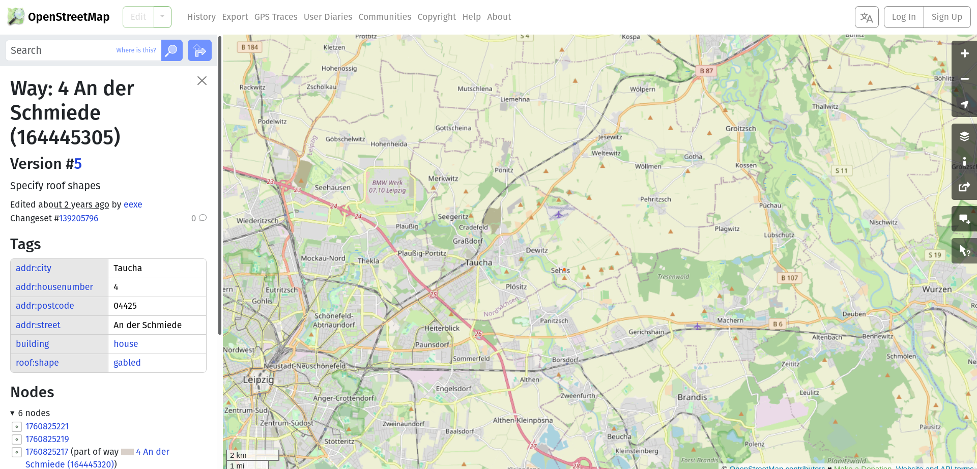
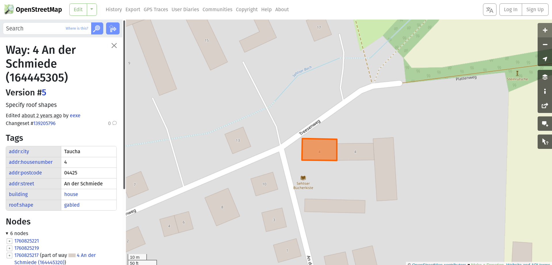
@douginamug What are you trying to do that a combination of #OSM `Layers` and `Share` can't?
#OpenStreetMap allows you to choose from 8x different map renders, and share with or without a marker, set zoom level, set a map area. You can choose form three different URL formats.
If you must, use +Codes, just avoid WrongThreeWords like the plague.
https://plus.codes/about/
@jamesderrick never heard of +Codes, interesting!
Share + marker indeed works, thanks. I think I knew it, but forgot. I somehow just expect right/left click to bring up the option. Something about the UI is off for me.
bonfire.cafe
A space for Bonfire maintainers and contributors to communicate
Automatic federation enabled