Discussion
Loading...

#Tag

  • About
  • Code of conduct
  • Privacy
  • Users
  • Instances
  • About Bonfire
Chris Alemany🇺🇦🇨🇦🇪🇸
@chris@mstdn.chrisalemany.ca  ·  activity timestamp 2 weeks ago

huh. TIL: there is a “four corners” place in Canada, like there is more famously in the USA, where Utah, Colorado, Arizona and New Mexico meet.

But ours is automatically cooler, figuratively and literally*, because it is a: at 60° Latitude, and b: involves two Territories and two Provinces.

It is where the Northwest Territories, Nunavut, Saskatchewan, and Manitoba meet.

It is also a LOT harder to get to. Though arguably, as it is amongst the thousands of lakes in the area, during the summer, a float plane would get you there.

Also, technically. It is not a perfect “joining” on the map which is just bad planning on Canada’s part, but at least it is hiking distance. Or that might be just a projection issue. They seem to converge at 60N 102W. I guess I could consult an official boundary document or something :)

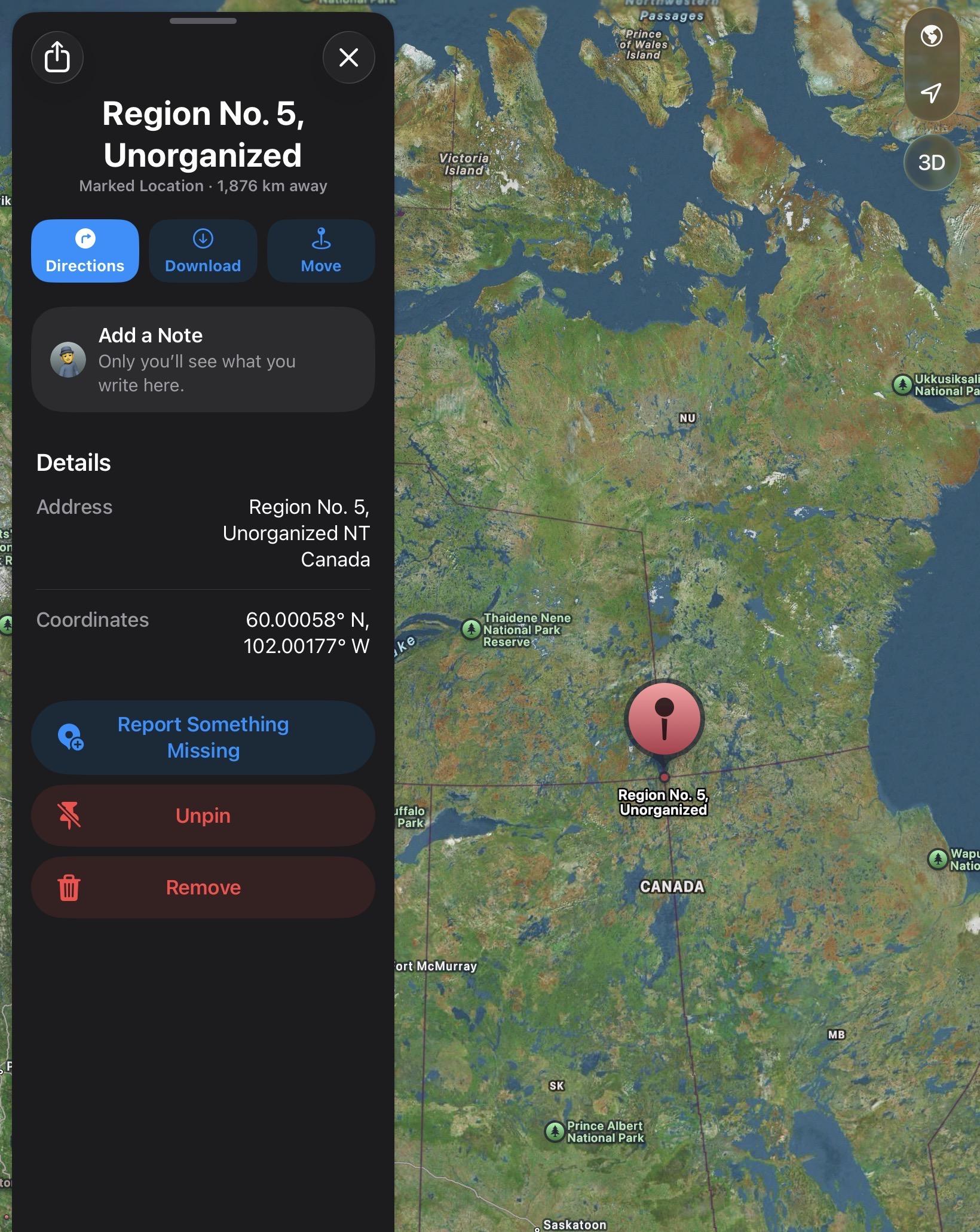
Apple Map location: https://maps.apple/p/W9ucIgoQCikMLM

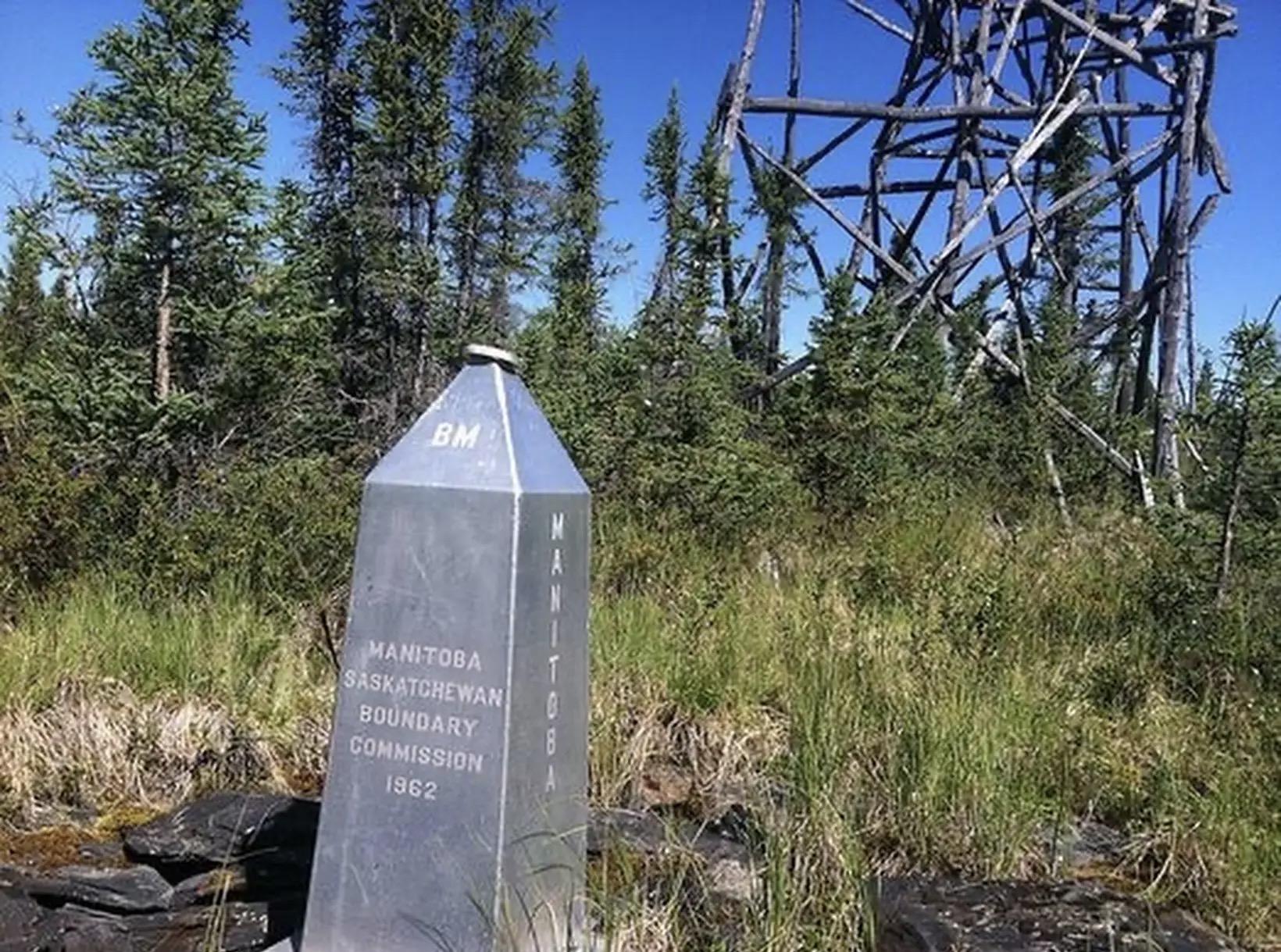
Edit: Google Maps has a photo! Added here… of the four cornered boundary monument!
*seasons and ongoing #agw not withstanding
#geography #uselessKnowledge #nerd #maps #canada #sk #mb #nwt #yt #climatechange
Apple Maps

A picture from Google Maps showing a silver metal obelisk style monument with the names of the provinces. In the background there appears to be a fire watch tower made from irregular local wood poles
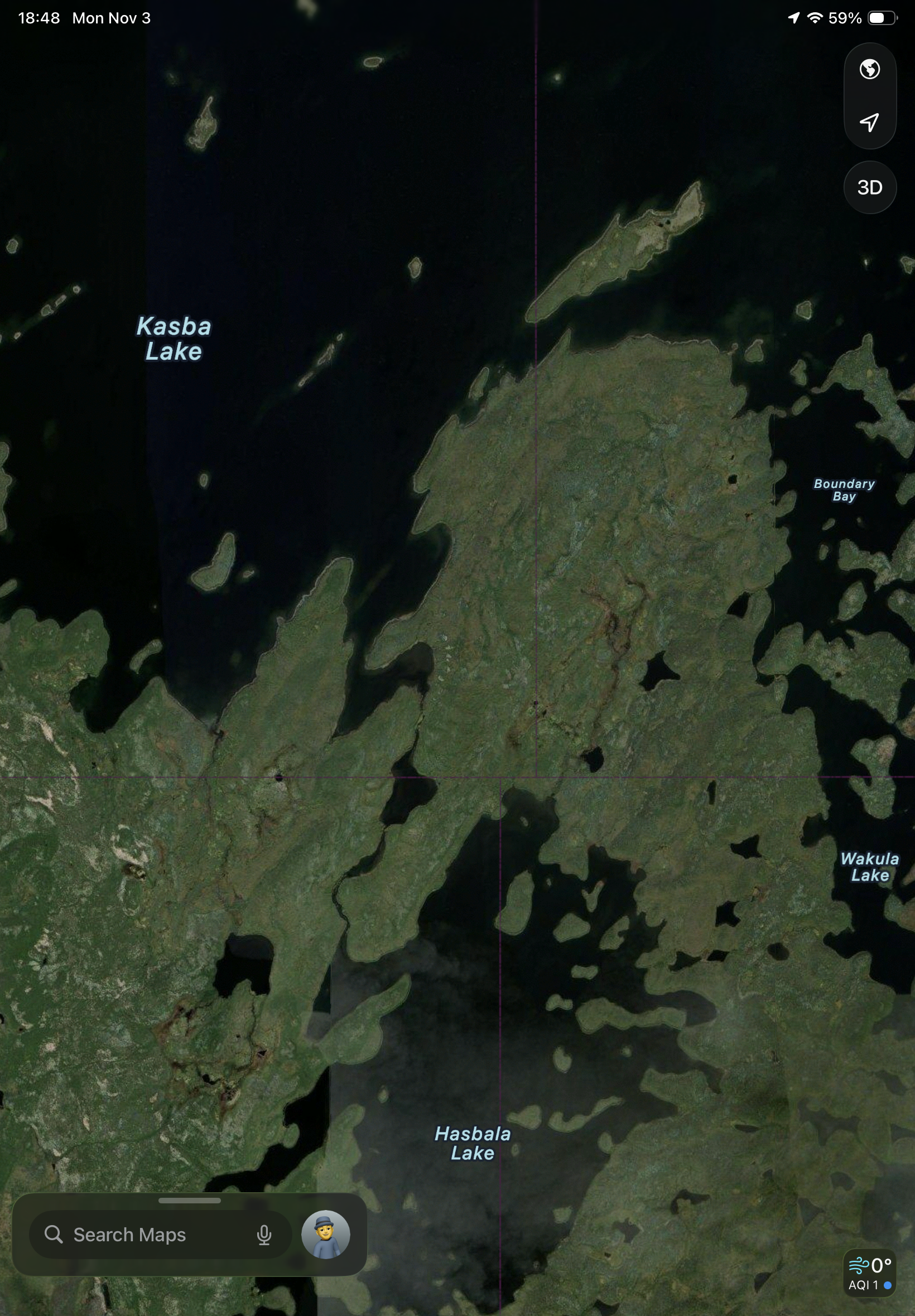
How much more zoomed in look shows the considerable lakes in the area immediately adjacent to the four corners. The lines don’t perfectly match up, but I suspect that has more to do with the projection and the physical location as intended.
Reasonably zoomed out map view of a point on the map at 60° north and 102° west. It shows the location of the four corners in North Central Canada.
  • Copy link
  • Flag this post
  • Block
Log in

bonfire.cafe

A space for Bonfire maintainers and contributors to communicate

bonfire.cafe: About · Code of conduct · Privacy · Users · Instances
Bonfire social · 1.0.0 no JS en
Automatic federation enabled
  • Explore
  • About
  • Members
  • Code of Conduct
Home
Login